
| Chamizal National Memorial | |
|---|---|
 Visitor Center at Chamizal National Memorial | |
 Chamizal National Memorial  Chamizal National Memorial | |
| Location | Paisano Dr., El Paso, Texas, USA |
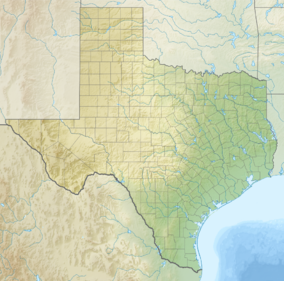
| Coordinates | 31°46′4″N 106°27′15″W / 31.76778°N 106.45417°W |
| Area | 54.90 acres (22.22 ha)[1] |
| Established | February 4, 1974 |
| Visitors | 8,324 (in 2023)[2] |
| Governing body | National Park Service |
| Website | Chamizal National Memorial |
Chamizal National Memorial | |
| Built | 1848 |
| NRHP reference No. | 74002069[3] |
| Added to NRHP | February 2, 1974 |
Chamizal National Memorial, located in El Paso, Texas, along the United States–Mexico international border, is a National Park Service site commemorating the peaceful settlement of the Chamizal boundary dispute.[4]
YouTube Encyclopedic
-
1/2Views:317353
-
Introduction to Chamizal National Memorial
-
Chamizal National Memorial
Transcription
Facility
The 54.90-acre (22.22 ha) memorial park serves primarily as a cultural center and contains art galleries, a theater, and an amphitheatre. A museum, which details the history of the U.S.–Mexico border, is located inside the visitor center. The park honors the peaceful resolution of the Chamizal dispute, a more than 100-year border dispute between the United States and Mexico that resulted from the natural change of course of the Rio Grande between the cities of El Paso and Ciudad Juárez, Chihuahua. This national memorial was established on part of the disputed land that was assigned to the United States according to the Chamizal Convention of 1963; a corresponding Parque Público Federal El Chamizal was created on the now-Mexican portion of the land.[5] The Chamizal Convention was negotiated by the International Boundary and Water Commission, which was established in 1889 to maintain the border, and pursuant to later treaties to allocate river waters between the two nations, and provide for flood control and water sanitation.[6]
Administrative history
The National Memorial was authorized on June 30, 1966. It was established as a National Park Service unit on February 4, 1974, and was administratively listed on the National Register of Historic Places the same day.[7]
Admission and hours
Fees and permits required to use the theater. Fees for picnic facilities for groups of 50 or more.[8]
Park grounds, 5 a.m. - 10 p.m. daily. Closed Thanksgiving, Christmas and New Year's Day.[9]
Visitors center and galleries open 10 a.m. - 5 p.m . Administration office open 8 a.m. - 4:30 p.m.[9]
See also
- National Register of Historic Places listings in El Paso County, Texas
- List of national memorials of the United States
References
- ^ "Listing of acreage – December 31, 2011" (XLSX). Land Resource Division, National Park Service. Retrieved 2012-12-26. (National Park Service Acreage Reports)
- ^ "NPS Annual Recreation Visits Report". National Park Service. Retrieved 2024-04-11.
- ^ "National Register Information System". National Register of Historic Places. National Park Service. July 9, 2010.
- ^ "Chamizal National Memorial". Travel Tex. Archived from the original on 18 January 2013. Retrieved 23 February 2012.
- ^ Long, Christopher. "Chamizal National Memorial". Handbook of Texas Online. Texas State Historical Association. Retrieved 23 February 2012.
- ^ Robert J. McCarthy, Executive Authority, Adaptive Treaty Interpretation, and the International Boundary and Water Commission, U.S.-Mexico, 14-2 U. Denv. Water L. Rev. 197(Spring 2011) (also available for free download at https://ssrn.com/abstract=1839903).
- ^ "NRHP Chamizal". Texas Historical Commission. Retrieved 23 February 2012.
- ^ "Picnic". National Park Service. Retrieved 23 February 2012.
- ^ a b "Chamizal". National Park Service. Retrieved 23 February 2012.
External links
- Official NPS website: Chamizal National Memorial
- NPS image archive
- Footage of the Chamizal National Memorial from Tapestry (1974) on the Texas Archive of the Moving Image

| Primary and secondary education |
|  | ||||||||||||
|---|---|---|---|---|---|---|---|---|---|---|---|---|---|---|
| Higher education | ||||||||||||||
| Library | ||||||||||||||
| Neighborhoods | ||||||||||||||
| Media |
| |||||||||||||
| Hospitals |
| |||||||||||||
| Military | ||||||||||||||
| Theaters | ||||||||||||||
| Museums |
| |||||||||||||
| Parks and gardens | ||||||||||||||
| International border crossings | ||||||||||||||
| Transportation | ||||||||||||||
| Organizations based in El Paso | ||||||||||||||
| Companies based in El Paso |
| |||||||||||||
| Sports | ||||||||||||||
| International | |
|---|---|
| National | |