
Chenango County | |
|---|---|
 Chenango County Courthouse | |
 Flag  Seal | |
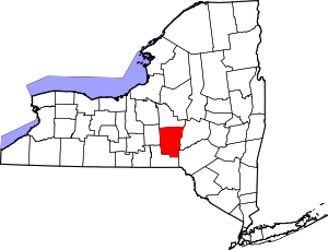 Location within the U.S. state of New York | |
 New York's location within the U.S. | |
| Coordinates: 42°30′N 75°37′W / 42.5°N 75.62°W | |
| Country | |
| State | |
| Founded | March 15, 1798 |
| Named for | Onondaga word for bull thistle |
| Seat | Norwich |
| Largest city | Norwich |
| Area | |
| • Total | 899 sq mi (2,330 km2) |
| • Land | 894 sq mi (2,320 km2) |
| • Water | 5.1 sq mi (13 km2) 0.6% |
| Population (2020) | |
| • Total | 47,220[1] |
| • Density | 52.8/sq mi (20.4/km2) |
| Time zone | UTC−5 (Eastern) |
| • Summer (DST) | UTC−4 (EDT) |
| Congressional district | 19th |
| Website | www |
Chenango County is a county located in the south-central section U.S. state of New York. As of the 2020 census, the population was 47,220.[2] Its county seat is Norwich.[3] The county's name originates from an Oneida word meaning 'large bull-thistle'.
YouTube Encyclopedic
-
1/2Views:4 928536
-
Chenango County, New York | Path Through History | WSKG
-
Probable bigfoot activity in Chenango County, NY.
Transcription
In 1791, the Scottish poet Robert Burns wrote the poem “flow gently, Sweet Afton” about a pastoral river in his native country. It was 1857 when the Village of South Bainbridge took its new name from that very poem. Located half-way between Oneonta and Binghamton, the Susquehanna River flows gently by the Town of Afton. Settled in 1792, the area is rich in history. In 1827, the Mormon Church founder Joseph Smith and Emma Hale were married at the Tarble homestead, now known as the Mormon House. Located on Main Street, the Afton Museum preserves and shares the history of this historic community. The museum, located in what was once a quaint house and barn, is now filled with exhibits focused on Native American Indian artifacts, Civil War items, farming equipment and much more. The museum also houses a number of artifacts associated with Joseph Smith, including a mantle piece from the old Mormon House. Here in Afton, where the Susquehanna “flows gently” and local history comes alive is another important stop on New York’s Path Through History. The arts are an important element in the history and heritage of a community. The mission of the Chenango Arts Council is to support life-enriching art throughout the greater Chenango region and to facilitate the discovery of art in everyday life. Located in the restored and repurposed Norwich High School building, art galleries and an elegant 500-seat theater now fill the space where former classrooms and an auditorium once existed. Two galleries provide professional exhibition space and showcase several exhibits throughout the year. The Martin W. Kappel theater features live performances, and provides an ideal venue for presentations, business seminars, weddings and other community events. The arts council also offers instructional classes, including design workshops and a Summer Art Camp for students. In addition to exhibitions, live performance and instructional workshops, the Arts Council supports the growth and development of the local arts by awarding grants to artists and organizations. Chenango Arts Council in Norwich, an artful blend of past and present, on New York’s Path Through History Over 50 years ago an abandoned school building in Norwich found new purpose. It was then that the Chenango County Historical Society acquired Ward School #2 on Rexford Street for use as a museum. Renovation began immediately on the 1896 building and soon the museum opened with exhibits spanning from the Revolutionary War period to the early 19th century. The Chenango County Historical Society Museum has continued to expand over the years. Today the museum includes major exhibits on the Chenango Canal, Native Americans, Mormons in Chenango County, and the internationally known Norwich Pharmacal Company. Other collections include displays on early telecommunications, photography, and pioneer and Victorian life. A one-room schoolhouse and maple sugar shack are included on the museum grounds, and a History Research Center is located next to the museum building. Half a century ago a landmark building in Norwich was saved and rehabilitated. Today, just like each of the exhibits within its rooms, the museum itself is a piece of local history on display at this stop on New York’s Path Through History. NORTHEAST CLASSIC CAR MUSEUM Located in Norwich, the Northeast Classic Car Museum first opened in 1997 with an exhibit of 50 vintage automobiles. The collection consisted of cars primarily manufactured by the Franklin Automobile Company of Syracuse, and each had been meticulously restored by local owner and collector George Staley. Today, thanks to generous donations, the collection has grown to over 160 vintage automobiles and fills five connected buildings. A carpeted walkway leads visitors through several themed exhibits where classic car models like the Franklin, the Pierce Arrow, Auburn, Maxwell, Delorean, and others great guests as they explore the museum. The Northeast Classic Car Museum, where sculpted hood ornaments, streamlined art deco styles, space-age tail fins and lots of chrome, bring fond memories and a new appreciation for automotive design on New York’s “Path Through History,” Located along the once busy Chenango Canal at the border of Chenango and Madison counties, the village of Earlville prospered in the mid-19th century. Today, painted-lady Victorian homes line village streets and the historic three-story brick Earlville Opera House stands central to the community. Built in 1892, the Opera House provided an essential venue for entertainment and community functions. Like most theaters, it evolved over the years in response to changing tastes. It originally hosted lavish theatrical productions, then vaudeville acts and eventually, motion pictures. Declining attendance finally forced the theater to close in the 1950’s. Then, in 1971 a group of concerned citizens developed a plan to bring the Opera House back to life. Two years later the building was listed on the National Register of Historic Places, and in 1975 the fully restored Opera House was once again open for business. Earlville’s Opera House soon regained its former status of providing top-notch performing arts entertainment. The pride of the community, Earlville Opera House represents historic preservation at its finest. It stands today as an example of this community’s passion for its past, and as a major landmark on New York’s “Path Through History.” To enter the business district of Greene is to take a step back in time. Name after Revolutionary War hero General Nathanael Greene, the town of Greene was formed in 1798. Located along the Chenango River, the town prospered along with the construction of the Chenango Canal and later a railroad line. Listed on the National Register of Historic Places since 1982, the Greene Historic District includes over 140 buildings, including the main commercial area and surrounding residential neighborhoods. The main street through town is lined with magnificent 19th century buildings, filled with quaint specialty shops, stores, cafes and restaurants. The 1886 municipal building stands as one of the area’s most prominent landmarks, as does the majestic Sherwood Hotel, built in 1913 and restored to its current glory in 1982. A visit to the Greene Historic District is like a step back in time on New York’s Path Through History. Located just across the Chenango River in the picturesque Village of Greene is the Juliand House. Built in 1810 by French seaman Joseph Juliand, the 22-room house is an excellent example of early 19th century Federal style architecture. There are many legends associated with the Juliand House. It is believed that during its early years Indians visited the house and spent nights in the center hall, and there is also some evidence that the house may have operated as a stop on the Underground Railroad in the mid-1800’s. Two hundred years after it was built, the home was converted into a bed and breakfast, where visitors can now experience warm, cozy accommodations in a quiet, relaxed 19th century setting. For over two centuries many important individuals have passed through this grand home, including French settlers, Native American Indians, fugitive slaves and abolitionists. Today, the 1810 Juliand House stands as a significant landmark in Chenango County and an important place for travelers to stop and rest on New York’s Path Through History.
History
This was long the territory of the Oneida people, one of the first Five Nations of the Iroquois Confederacy or Haudenosaunee. They occupied the area until after the Revolutionary War, when they were forced off the land, although they had been allies of the patriot colonists. They were granted a small reservation, which settlers continued to encroach on.
When English colonists organized counties in 1683 in what is now New York, the present Chenango County was part of Albany County. This was an enormous county, including the northern part of New York State as well as all of the present State of Vermont and, in theory, extending westward to the Pacific Ocean. However, territories located to the west of present-day Pennsylvania were under effective French control as part of New France. Albany County was reduced in size on July 3, 1766, by the creation of Cumberland County, and further on March 16, 1770, by the creation of Gloucester County, both containing territory now in Vermont.
On March 12, 1772, what was left of Albany County was split into three parts, one remaining under the name Albany County. One of the other pieces, Tryon County, contained the western portion (and thus, since no western boundary was specified, theoretically still extended west to the Pacific). The eastern boundary of Tryon County was approximately five miles west of the present city of Schenectady, and the county included the western part of the Adirondack Mountains and the area west of the West Branch of the Delaware River. The area then designated as Tryon County has since been organized as 37 counties of New York State. The county was named for William Tryon, the British colonial governor of New York.
In the years prior to 1776, during the increasing tensions most of the Loyalists in Tryon County fled to Fort Niagara on the Western Frontier. In 1784, following the peace treaty that ended the American Revolutionary War, the Americans renamed Tryon County as Montgomery County in honor of the US general, Richard Montgomery. He had captured several places in Canada and died attempting to capture the city of Quebec. The US residents replaced the name of the former British governor.

In 1788, the Oneida Reservation was considerably reduced by what is known as Clinton's Purchase, when land was sold off west of the Unadilla River to create what are now 20 towns. (See map to the right.) Settlers from eastern New York and New England entered the area and began farming.
In 1789, Montgomery County was reduced in size by the splitting-off of Ontario County. The area split off from Montgomery County was much larger than the present Ontario County, as it included the present Allegany, Cattaraugus, Chautauqua, Erie, Genesee, Livingston, Monroe, Niagara, Orleans, Steuben, Wyoming, Yates, and part of Schuyler and Wayne counties. It was the practice to establish a large geographic county and divide it as settlement increased.
In 1791, Herkimer, Otsego and Tioga counties were organized from land separated from Montgomery County.
Chenango County was formed on March 15, 1798, from 1,610 square miles (4,170 km2) of Tioga and Herkimer counties. Its eastern border is formed by the Unadilla River. The land had been purchased the previous year from the Oneida, who were forced into a smaller reservation to the north.
On April 4, 1804, 70 square miles (180 km2) of Chenango County was partitioned to expand Oneida County; the communities of Waterville and Sangerfield were assigned to the new Oneida County.
On March 21, 1806, 650 square miles (1,680 km2) of Chenango County was partitioned to produce Madison County. This established the current borders of Chenango County, which have been maintained to the early 21st century. This area was developed for agriculture in the nineteenth century and is still largely rural.
Geography
According to the U.S. Census Bureau, the county has a total area of 899 square miles (2,330 km2), of which 894 square miles (2,320 km2) is land and 5.1 square miles (13 km2) (0.6%) is water.[4]
Chenango County is in the approximate center of the state, located west of Albany, north of Binghamton, and southeast of Syracuse. The county is considered to be in the Southern Tier region of New York State.
The Chenango River, a tributary of the Susquehanna River, flows southward through the county.
Adjacent counties
- Madison County - north
- Otsego County - northeast
- Delaware County - southeast
- Broome County - south
- Cortland County - west
Demographics
| Census | Pop. | Note | %± |
|---|---|---|---|
| 1800 | 15,666 | — | |
| 1810 | 21,704 | 38.5% | |
| 1820 | 31,215 | 43.8% | |
| 1830 | 37,238 | 19.3% | |
| 1840 | 40,785 | 9.5% | |
| 1850 | 40,311 | −1.2% | |
| 1860 | 40,934 | 1.5% | |
| 1870 | 40,564 | −0.9% | |
| 1880 | 39,891 | −1.7% | |
| 1890 | 37,776 | −5.3% | |
| 1900 | 36,568 | −3.2% | |
| 1910 | 35,575 | −2.7% | |
| 1920 | 34,969 | −1.7% | |
| 1930 | 34,665 | −0.9% | |
| 1940 | 36,454 | 5.2% | |
| 1950 | 39,138 | 7.4% | |
| 1960 | 43,243 | 10.5% | |
| 1970 | 46,368 | 7.2% | |
| 1980 | 49,344 | 6.4% | |
| 1990 | 51,768 | 4.9% | |
| 2000 | 51,401 | −0.7% | |
| 2010 | 50,477 | −1.8% | |
| 2020 | 47,220 | −6.5% | |
| 2022 (est.) | 46,458 | [5] | −1.6% |
| U.S. Decennial Census[6] 1790-1960[7] 1900-1990[8] 1990-2000[9] 2010-2020[2] | |||
2020 Census
| Race | Num. | Perc. |
|---|---|---|
| White (NH) | 43,153 | 91.39% |
| Black or African American (NH) | 345 | 0.73% |
| Native American (NH) | 93 | 0.19% |
| Asian (NH) | 236 | 0.5% |
| Pacific Islander (NH) | 15 | 0.03% |
| Other/Mixed (NH) | 2,261 | 4.79% |
| Hispanic or Latino | 1,117 | 2.37% |
2000 Census
As of the census[11] of 2000, there were 51,401 people, 19,926 households, and 13,549 families residing in the county. The population density was 58 people per square mile (22 people/km2). There were 23,890 housing units at an average density of 27 per square mile (10/km2). The racial makeup of the county was 97.65% White, 0.82% Black or African American, 0.27% Native American, 0.28% Asian, 0.02% Pacific Islander, 0.22% from other races, and 0.74% from two or more races. 1.07% of the population were Hispanic or Latino of any race. 20.2% were of English, 14.5% German, 13.8% Irish, 12.3% American and 8.9% Italian ancestry according to Census 2000.[12] 96.7% spoke English and 1.3% Spanish as their first language.
There were 19,926 households, out of which 32.50% had children under the age of 18 living with them, 53.10% were married couples living together, 9.80% had a female householder with no husband present, and 32.00% were non-families. 26.10% of all households were made up of individuals, and 11.40% had someone living alone who was 65 years of age or older. The average household size was 2.52 and the average family size was 3.01.
In the county, the population was spread out, with 26.20% under the age of 18, 7.00% from 18 to 24, 27.50% from 25 to 44, 24.40% from 45 to 64, and 14.90% who were 65 years of age or older. The median age was 38 years. For every 100 females there were 97.00 males. For every 100 females age 18 and over, there were 94.70 males.
The median income for a household in the county was $33,679, and the median income for a family was $39,711. Males had a median income of $30,363 versus $22,429 for females. The per capita income for the county was $16,427. About 10.70% of families and 14.40% of the population were below the poverty line, including 19.50% of those under age 18 and 8.70% of those age 65 or over.
Government
| Year | Republican | Democratic | Third party | |||
|---|---|---|---|---|---|---|
| No. | % | No. | % | No. | % | |
| 2020 | 13,496 | 60.38% | 8,300 | 37.14% | 554 | 2.48% |
| 2016 | 11,921 | 59.13% | 6,775 | 33.61% | 1,464 | 7.26% |
| 2012 | 9,713 | 50.29% | 9,116 | 47.20% | 485 | 2.51% |
| 2008 | 10,337 | 49.59% | 10,100 | 48.45% | 410 | 1.97% |
| 2004 | 11,582 | 54.27% | 9,277 | 43.47% | 482 | 2.26% |
| 2000 | 10,033 | 49.55% | 9,112 | 45.00% | 1,105 | 5.46% |
| 1996 | 7,319 | 37.96% | 8,797 | 45.63% | 3,163 | 16.41% |
| 1992 | 8,114 | 37.24% | 8,017 | 36.80% | 5,656 | 25.96% |
| 1988 | 11,727 | 58.92% | 8,021 | 40.30% | 154 | 0.77% |
| 1984 | 14,254 | 69.03% | 6,343 | 30.72% | 51 | 0.25% |
| 1980 | 10,400 | 53.08% | 6,917 | 35.31% | 2,275 | 11.61% |
| 1976 | 12,384 | 62.43% | 7,356 | 37.08% | 97 | 0.49% |
| 1972 | 13,770 | 70.58% | 5,695 | 29.19% | 44 | 0.23% |
| 1968 | 11,785 | 63.86% | 5,706 | 30.92% | 964 | 5.22% |
| 1964 | 7,293 | 38.48% | 11,653 | 61.49% | 6 | 0.03% |
| 1960 | 14,533 | 71.93% | 5,659 | 28.01% | 12 | 0.06% |
| 1956 | 16,314 | 81.09% | 3,804 | 18.91% | 0 | 0.00% |
| 1952 | 16,062 | 79.66% | 4,089 | 20.28% | 13 | 0.06% |
| 1948 | 11,988 | 70.59% | 4,764 | 28.05% | 230 | 1.35% |
| 1944 | 12,745 | 71.69% | 4,997 | 28.11% | 37 | 0.21% |
| 1940 | 14,168 | 72.84% | 5,241 | 26.94% | 43 | 0.22% |
| 1936 | 13,772 | 72.50% | 5,143 | 27.08% | 80 | 0.42% |
| 1932 | 11,566 | 65.27% | 5,953 | 33.60% | 200 | 1.13% |
| 1928 | 13,955 | 77.21% | 3,986 | 22.05% | 132 | 0.73% |
| 1924 | 11,323 | 72.60% | 3,392 | 21.75% | 881 | 5.65% |
| 1920 | 10,116 | 71.12% | 3,735 | 26.26% | 373 | 2.62% |
| 1916 | 5,198 | 54.77% | 3,887 | 40.96% | 405 | 4.27% |
| 1912 | 4,043 | 42.71% | 3,341 | 35.29% | 2,082 | 21.99% |
| 1908 | 5,949 | 57.52% | 3,772 | 36.47% | 621 | 6.00% |
| 1904 | 6,394 | 59.77% | 3,817 | 35.68% | 486 | 4.54% |
| 1900 | 6,362 | 58.89% | 4,043 | 37.42% | 398 | 3.68% |
| 1896 | 6,338 | 59.09% | 3,973 | 37.04% | 415 | 3.87% |
| 1892 | 5,378 | 51.04% | 4,273 | 40.56% | 885 | 8.40% |
| 1888 | 5,798 | 52.49% | 4,640 | 42.01% | 608 | 5.50% |
| 1884 | 5,462 | 50.99% | 4,410 | 41.17% | 840 | 7.84% |
Chenango County has a Board of Supervisors that consists of 23 Town/City elected officials, serving as representatives at the County level. The term for each Supervisor is based on the term set by each particular Town. A Supervisor holds office for either two or four years.
In 21st-century United States politics, Chenango County is considered to be a Republican-leaning county, where the majority of voters elect national Republican candidates. In 2004, Republican George Bush won by an 11% margin over Democrat John Kerry. For state and congressional offices, voters sometimes elect Democratic candidates. In 2006 both Eliot Spitzer and Hillary Clinton carried it, winning 57% and 54% of the vote for governor and US Senator, respectively. In 2008, John McCain carried Chenango County over Barack Obama in the presidential election by a close margin of 49.59%-48.45% or a difference of 237 votes.[14] In 2010, Democrat Andrew Cuomo for governor, and Democrats Chuck Schumer and Kirsten Gillibrand for the US Senate each carried it. In 2012, Republican Mitt Romney narrowly won the county over Obama, but like most of the Upstate, swung sharply towards the Republicans in 2016 and 2020, with Donald Trump receiving over 60% of the vote in 2020 making him the first Republican to do so since 1984.
Education
Morrisville State College has a branch in Norwich.
Communities
Norwich, the county seat, is the only city in Chenango County.
In addition to the city of Norwich, the county has the following named settlements:
Towns
In New York, a "town" is a political subdivision (synonymous with township). The towns in northern Chenango County originated from the Twenty Townships ceded by the Oneida tribe to the State of New York.
Villages
Census-designated places
Hamlets
Notable people
- Allen Aaron Cook an architect, was born here in 1832
- Nancy Matthews Elliott was born here in 1810 and became the mother of Thomas Edison.
- Serranus Clinton Hastings, U.S. Congressman and founder of the Hastings College of the Law at University of California[15]
See also
- List of counties in New York
- National Register of Historic Places listings in Chenango County, New York
References
- ^ "US Census 2020 Population Dataset Tables for New York". United States Census Bureau. Retrieved January 2, 2022.
- ^ a b "U.S. Census Bureau QuickFacts: Chenango County, New York". United States Census Bureau. Retrieved January 3, 2022.
- ^ "Find a County". National Association of Counties. Archived from the original on May 31, 2011. Retrieved June 7, 2011.
- ^ "2010 Census Gazetteer Files". United States Census Bureau. August 22, 2012. Archived from the original on May 19, 2014. Retrieved January 3, 2015.
- ^ "QuickFacts". United States Census Bureau. Retrieved March 2, 2024.
- ^ "U.S. Decennial Census". United States Census Bureau. Retrieved January 3, 2015.
- ^ "Historical Census Browser". University of Virginia Library. Archived from the original on December 26, 2013. Retrieved January 3, 2015.
- ^ "Population of Counties by Decennial Census: 1900 to 1990". United States Census Bureau. Retrieved January 3, 2015.
- ^ "Census 2000 PHC-T-4. Ranking Tables for Counties: 1990 and 2000" (PDF). United States Census Bureau. Retrieved January 3, 2015.
- ^ "P2 HISPANIC OR LATINO, AND NOT HISPANIC OR LATINO BY RACE – 2020: DEC Redistricting Data (PL 94-171) – Chenango County, New York".
- ^ "U.S. Census website". United States Census Bureau. Retrieved January 31, 2008.
- ^ "Census.gov". Census.gov.
- ^ Leip, David. "Dave Leip's Atlas of U.S. Presidential Elections". uselectionatlas.org. Retrieved October 22, 2018.
- ^ "Dave Leip's Atlas of U.S. Presidential Elections - State Data".
- ^ Bacon and Company (1870). Representative and leading men of the Pacific. Bacon and Company. p. 433.
serranus hastings principal at Norwich Academy, located in Chenango County, New York.
Further reading
- NEW YORK: Atlas of Historical County Boundaries; Compiled by Kathryn Ford Thorne; Edited by John H. Long.
External links
- Chenango County, NY government
- Chenango County "Online Visitors Travel Guide"
- Chenango County at Curlie
- Chenango County GenWeb
- Chenango County Chamber of Commerce
- Chenango County Democratic Committee
- The Evening Sun, Chenango County newspaper
- Chenango Semi-Weekly Telegraph, Google news archive. —PDFs of 2,579 issues, dating from 1877 through 1934.
Places adjacent to Chenango County, New York | ||||||||||||||||
|---|---|---|---|---|---|---|---|---|---|---|---|---|---|---|---|---|
| ||||||||||||||||
Municipalities and communities of Chenango County, New York, United States | ||
|---|---|---|
| City |  | |
| Towns | ||
| Villages | ||
| CDPs | ||
| Hamlets | ||
| Footnotes | ‡This populated place also has portions in an adjacent county or counties | |
42°30′N 75°37′W / 42.50°N 75.62°W
| International | |
|---|---|
| National | |
| Geographic | |