
Clark County | |
|---|---|
 Clark County Courthouse | |
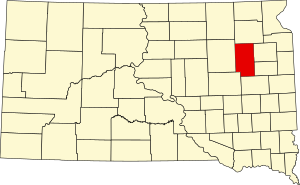 Location within the U.S. state of South Dakota | |
 South Dakota's location within the U.S. | |
| Coordinates: 44°52′N 97°44′W / 44.86°N 97.73°W | |
| Country | |
| State | |
| Founded | 1873 (created) 1881 (organized) |
| Named for | Newton Clark |
| Seat | Clark |
| Largest city | Clark |
| Area | |
| • Total | 967 sq mi (2,500 km2) |
| • Land | 958 sq mi (2,480 km2) |
| • Water | 9.9 sq mi (26 km2) 1.0% |
| Population (2020) | |
| • Total | 3,837 |
| • Estimate (2023) | 3,948 |
| • Density | 4.0/sq mi (1.5/km2) |
| Time zone | UTC−6 (Central) |
| • Summer (DST) | UTC−5 (CDT) |
| Congressional district | At-large |
| Website | http://clark.sdcounties.org/ |
Clark County is a county in the U.S. state of South Dakota. As of the 2020 census, the population was 3,837.[1] Its county seat is Clark.[2] The county was created in 1873 and organized in 1881.[3] It was named for Newton Clark, a Dakota Territory legislator in 1873.[4][5]
YouTube Encyclopedic
-
1/5Views:2 024195 6676 911699 2723 030
-
Clark, SD and Dakota Style
-
Cheapest towns to live in South Dakota. Top 10
-
South Dakota Scenic Ranch For Sale
-
Town Pays $10,000 After Police Encounter
-
🇺🇸 [4K60] Yankton, South Dakota! 🚘 Drive with me!
Transcription
Geography
Clark County terrain consists of rolling hills, dotted with lakes and ponds especially in the east central portion. The area is mostly devoted to agriculture.[6] The county has a total area of 967 square miles (2,500 km2), of which 958 square miles (2,480 km2) is land and 9.9 square miles (26 km2) (1.0%) is water.[7]
Major highways
Adjacent counties
- Day County - north
- Codington County - east
- Hamlin County - southeast
- Kingsbury County - south
- Beadle County - southwest
- Spink County - west
Protected areas
Lakes and reservoirs
Demographics
| Census | Pop. | Note | %± |
|---|---|---|---|
| 1880 | 114 | — | |
| 1890 | 6,728 | 5,801.8% | |
| 1900 | 6,942 | 3.2% | |
| 1910 | 10,901 | 57.0% | |
| 1920 | 11,136 | 2.2% | |
| 1930 | 11,022 | −1.0% | |
| 1940 | 8,955 | −18.8% | |
| 1950 | 8,369 | −6.5% | |
| 1960 | 7,134 | −14.8% | |
| 1970 | 5,515 | −22.7% | |
| 1980 | 4,894 | −11.3% | |
| 1990 | 4,403 | −10.0% | |
| 2000 | 4,143 | −5.9% | |
| 2010 | 3,691 | −10.9% | |
| 2020 | 3,837 | 4.0% | |
| 2023 (est.) | 3,948 | [21] | 2.9% |
| U.S. Decennial Census[22] 1790-1960[23] 1900-1990[24] 1990-2000[25] 2010-2020[1] | |||
2020 census
As of the 2020 census, there were 3,837 people, 1,361 households, and 853 families residing in the county.[26] The population density was 4.0 inhabitants per square mile (1.5/km2). There were 1,603 housing units.
2010 census
As of the 2010 census, there were 3,691 people, 1,445 households, and 929 families residing in the county. The population density was 3.9 inhabitants per square mile (1.5/km2). There were 1,710 housing units at an average density of 1.8 per square mile (0.69/km2). The racial makeup of the county was 98.1% white, 0.2% black or African American, 0.1% Asian, 0.1% American Indian, 0.8% from other races, and 0.8% from two or more races. Those of Hispanic or Latino origin made up 1.7% of the population. In terms of ancestry, 52.0% were German, 29.4% were Norwegian, 9.7% were Irish, 7.8% were English, 5.4% were Swedish, and 3.5% were American.
Of the 1,445 households, 23.0% had children under the age of 18 living with them, 55.8% were married couples living together, 4.8% had a female householder with no husband present, 35.7% were non-families, and 32.5% of all households were made up of individuals. The average household size was 2.22 and the average family size was 2.79. The median age was 45.7 years.
The median income for a household in the county was $43,894 and the median income for a family was $55,575. Males had a median income of $33,606 versus $24,952 for females. The per capita income for the county was $23,909. About 7.5% of families and 13.1% of the population were below the poverty line, including 24.5% of those under age 18 and 12.6% of those age 65 or over.
Communities
Cities
- Clark (county seat)
- Willow Lake
Towns
Census-designated place
Unincorporated communities
Townships
- Ash
- Blaine
- Collins
- Cottonwood
- Darlington
- Day
- Eden
- Fordham
- Foxton
- Garfield
- Hague
- Lake
- Lincoln
- Logan
- Maydell
- Merton
- Mount Pleasant
- Pleasant
- Raymond
- Richland
- Rosedale
- Spring Valley
- Thorp
- Warren
- Washington
- Woodland
Politics
Clark County is a reliable state bellwether, having voted for South Dakota's statewide winner in every presidential election since statehood, similar to Jackson County and Jones County. It is a strongly Republican county, having voted for the Republican candidate in presidential election since 1968.
| Year | Republican | Democratic | Third party | |||
|---|---|---|---|---|---|---|
| No. | % | No. | % | No. | % | |
| 2020 | 1,373 | 74.22% | 437 | 23.62% | 40 | 2.16% |
| 2016 | 1,139 | 68.74% | 398 | 24.02% | 120 | 7.24% |
| 2012 | 1,067 | 58.59% | 713 | 39.15% | 41 | 2.25% |
| 2008 | 1,065 | 54.90% | 830 | 42.78% | 45 | 2.32% |
| 2004 | 1,435 | 61.67% | 875 | 37.60% | 17 | 0.73% |
| 2000 | 1,272 | 60.34% | 791 | 37.52% | 45 | 2.13% |
| 1996 | 998 | 44.51% | 956 | 42.64% | 288 | 12.85% |
| 1992 | 803 | 33.81% | 799 | 33.64% | 773 | 32.55% |
| 1988 | 1,247 | 51.44% | 1,164 | 48.02% | 13 | 0.54% |
| 1984 | 1,748 | 64.31% | 960 | 35.32% | 10 | 0.37% |
| 1980 | 1,963 | 67.43% | 774 | 26.59% | 174 | 5.98% |
| 1976 | 1,449 | 51.06% | 1,376 | 48.48% | 13 | 0.46% |
| 1972 | 1,617 | 54.59% | 1,336 | 45.10% | 9 | 0.30% |
| 1968 | 1,596 | 52.50% | 1,325 | 43.59% | 119 | 3.91% |
| 1964 | 1,511 | 46.04% | 1,771 | 53.96% | 0 | 0.00% |
| 1960 | 2,204 | 61.05% | 1,406 | 38.95% | 0 | 0.00% |
| 1956 | 2,173 | 58.83% | 1,521 | 41.17% | 0 | 0.00% |
| 1952 | 2,692 | 71.44% | 1,076 | 28.56% | 0 | 0.00% |
| 1948 | 1,625 | 50.59% | 1,559 | 48.54% | 28 | 0.87% |
| 1944 | 1,936 | 61.56% | 1,209 | 38.44% | 0 | 0.00% |
| 1940 | 2,622 | 61.75% | 1,624 | 38.25% | 0 | 0.00% |
| 1936 | 1,883 | 46.07% | 2,036 | 49.82% | 168 | 4.11% |
| 1932 | 1,572 | 36.56% | 2,649 | 61.60% | 79 | 1.84% |
| 1928 | 2,665 | 65.46% | 1,370 | 33.65% | 36 | 0.88% |
| 1924 | 1,684 | 56.85% | 325 | 10.97% | 953 | 32.17% |
| 1920 | 1,753 | 60.24% | 437 | 15.02% | 720 | 24.74% |
| 1916 | 1,226 | 52.71% | 1,016 | 43.68% | 84 | 3.61% |
| 1912 | 0 | 0.00% | 668 | 38.48% | 1,068 | 61.52% |
| 1908 | 1,234 | 64.37% | 557 | 29.06% | 126 | 6.57% |
| 1904 | 1,409 | 73.85% | 276 | 14.47% | 223 | 11.69% |
| 1900 | 996 | 54.16% | 752 | 40.89% | 91 | 4.95% |
| 1896 | 695 | 45.01% | 816 | 52.85% | 33 | 2.14% |
| 1892 | 731 | 47.19% | 197 | 12.72% | 621 | 40.09% |
See also
References
- ^ a b "State & County QuickFacts". United States Census Bureau. Retrieved March 21, 2024.
- ^ "Find a County". National Association of Counties. Archived from the original on May 31, 2011. Retrieved June 7, 2011.
- ^ "Dakota Territory, South Dakota, and North Dakota: Individual County Chronologies". Dakota Territory Atlas of Historical County Boundaries. The Newberry Library. 2006. Archived from the original on April 2, 2018. Retrieved March 29, 2015.
- ^ Gannett, Henry (1905). The Origin of Certain Place Names in the United States. Govt. Print. Off. p. 82.
- ^ Chicago and North Western Railway Company (1908). A History of the Origin of the Place Names Connected with the Chicago & North Western and Chicago, St. Paul, Minneapolis & Omaha Railways. p. 57.
- ^ Clark County SD Google Maps (accessed January 31, 2019)
- ^ "2010 Census Gazetteer Files". United States Census Bureau. August 22, 2012. Retrieved March 23, 2015.
- ^ Christopherson State Public Shooting Area, Vienna SD Google Maps (accessed January 31, 2019)
- ^ Dry Lake Number 2 State Public Shooting Area, Willow Lake SD Google Maps (accessed January 31, 2019)
- ^ Fordham State Public Shooting Area Google Maps (accessed January 31, 2019)
- ^ McPeek State Public Shooting Area, Willow Lake SD Google Maps (accessed January 31, 2019)
- ^ Stairs Slough State Public Shooting Area, Clark SD Google Maps (accessed January 31, 2019)
- ^ Willow Lake State Public Shooting Area, Willow Lake SD Google Maps (accessed January 31, 2019)
- ^ Baileys Lake Google Maps (accessed January 31, 2019)
- ^ Dry Lake Number One Google Maps (accessed January 31, 2019)
- ^ Dry Lake Number Two Google Maps (accessed January 31, 2019)
- ^ Mud Lake Google Maps (accessed January 31, 2019)
- ^ Reid Lake Google Maps (accessed January 31, 2019)
- ^ Swan Lake Google Maps (accessed January 31, 2019)
- ^ Willow Lake SD Google Maps (accessedJanuary 31, 2019)
- ^ "County Population Totals and Components of Change: 2020-2023". Retrieved March 17, 2024.
- ^ "U.S. Decennial Census". United States Census Bureau. Retrieved March 23, 2015.
- ^ "Historical Census Browser". University of Virginia Library. Archived from the original on August 11, 2012. Retrieved March 23, 2015.
- ^ Forstall, Richard L., ed. (March 27, 1995). "Population of Counties by Decennial Census: 1900 to 1990". USCensus Bureau. Retrieved March 23, 2015.
- ^ "Census 2000 PHC-T-4. Ranking Tables for Counties: 1990 and 2000" (PDF). United States Census Bureau. April 2, 2001. Archived (PDF) from the original on October 9, 2022. Retrieved March 23, 2015.
- ^ "US Census Bureau, Table P16: Household Type". United States Census Bureau. Retrieved March 20, 2024.
- ^ Leip, David. "Atlas of US Presidential Elections". uselectionatlas.org. Retrieved April 13, 2018.
Places adjacent to Clark County, South Dakota | ||||||||||||||||
|---|---|---|---|---|---|---|---|---|---|---|---|---|---|---|---|---|
| ||||||||||||||||
Municipalities and communities of Clark County, South Dakota, United States | ||
|---|---|---|
| Cities |  | |
| Towns | ||
| CDPs | ||
| Other communities | ||
44°52′N 97°44′W / 44.86°N 97.73°W
| International | |
|---|---|
| National | |
| Other | |