Comoé District
District du Comoé | |
|---|---|
 | |
| Country | |
| Established | 2011 |
| Capital | Abengourou |
| Area | |
| • Total | 14,150 km2 (5,460 sq mi) |
| Population (2021)[2] | |
| • Total | 1,501,336 |
| • Density | 110/km2 (270/sq mi) |
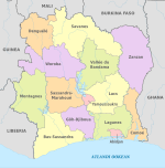
Comoé District (French: District du Comoé; pronounced [ko.mo.e], named for the Komoé River) is one of fourteen administrative districts of Ivory Coast. The district is located in the southeast corner of the country, bordering Ghana to the east, Zanzan District to the north, Lacs District and Lagunes District to the west, and the Atlantic Ocean to the south. The capital of the district is Abengourou.
YouTube Encyclopedic
-
1/1Views:460
-
Driving in Côte D'Ivoire (Ivory Coast) from Bassam to Bonoua.
Transcription
Creation
Comoé District was created in a 2011 administrative reorganisation of the subdivisions of Ivory Coast.[3] The territory of the district was composed by merging the former regions of Moyen-Comoé and Sud-Comoé.[1]
Administrative divisions
Comoé District is currently subdivided into two regions and the following departments:
- Indénié-Djuablin Region (formerly Moyen-Comoé Region) (region seat also in Abengourou)
- Sud-Comoé Region (region seat in Aboisso)
Population
According to the 2021 census, Comoé District has a population of 1,501,366.[2]
References
- ^ a b "Districts of Côte d'Ivoire (Ivory Coast)". Statoids.com. Retrieved 24 June 2015.
- ^ a b Citypopulation.de Population of the districts of Ivory Coast
- ^ Décret n° 2011-263 du 28 septembre 2011 portant organisation du territoire national en Districts et en Régions.
6°44′N 3°29′W / 6.733°N 3.483°W

