

Size of this preview: 701 × 599 pixels. Other resolutions: 281 × 240 pixels | 561 × 480 pixels | 898 × 768 pixels | 1,198 × 1,024 pixels | 1,580 × 1,351 pixels.
Original file (1,580 × 1,351 pixels, file size: 1.1 MB, MIME type: image/jpeg)
| This is a file from the Wikimedia Commons. Information from its description page there is shown below. Commons is a freely licensed media file repository. You can help. |
India
Summary
| Description |
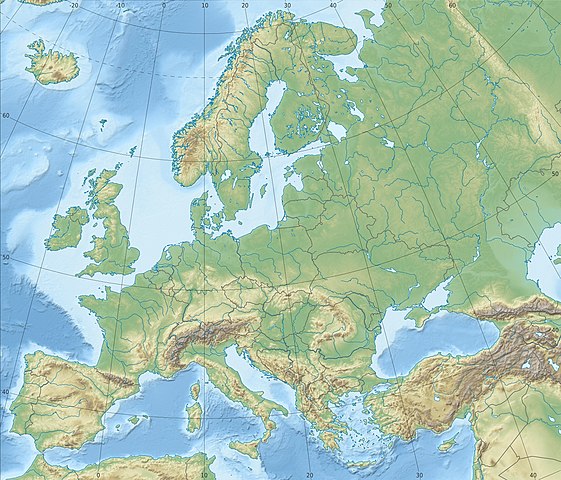
Physical location map Europe; Lambert azimuthal equal-area projection
|
| Date | |
| Source |
Own work
|
| Author | Alexrk2 |
| Other versions |
Derivative works of this file:
[]
|


.svg)


_ru.svg)

|
This map has been made or improved in the German Kartenwerkstatt (Map Lab). You can propose maps to improve as well.
|
Licensing
I, the copyright holder of this work, hereby publish it under the following license:
This file is licensed under the Creative Commons Attribution-Share Alike 3.0 Unported license.
- You are free:
- to share – to copy, distribute and transmit the work
- to remix – to adapt the work
- Under the following conditions:
- attribution – You must give appropriate credit, provide a link to the license, and indicate if changes were made. You may do so in any reasonable manner, but not in any way that suggests the licensor endorses you or your use.
- share alike – If you remix, transform, or build upon the material, you must distribute your contributions under the same or compatible license as the original.
File history
Click on a date/time to view the file as it appeared at that time.
| Date/Time | Thumbnail | Dimensions | User | Comment | |
|---|---|---|---|---|---|
| current | 22:29, 4 July 2018 | | 1,580 × 1,351 (1.1 MB) | Subtropical-man | Reverted to version as of 22:56, 20 August 2012 (UTC) |
| 17:54, 2 July 2018 |  | 1,580 × 1,351 (821 KB) | 1970gemini | fiat lux | |
| 22:56, 20 August 2012 |  | 1,580 × 1,351 (1.1 MB) | McZusatz | Reverted to version as of 10:53, 14 March 2010 (...thumb fixed?) | |
| 22:55, 20 August 2012 |  | 120 × 103 (4 KB) | McZusatz | fixing thumb... | |
| 10:53, 14 March 2010 |  | 1,580 × 1,351 (1.1 MB) | Alexrk2 | == Summary == {{Information |Description= {{de|Physische Positionskarte Europa; Flächentreue Azimutalprojektion}} {{en|Physical location map Europe; Lambert azimuthal equal-area projection}} * Projection: LAEA Europe, [http: |
File usage
More than 100 pages use this file. The following list shows the first 100 pages that use this file only. A full list is available.
- 's-Hertogenbosch
- Aarhus
- Aberdeen
- Alkmaar
- Amersfoort
- Amsterdam
- Apeldoorn
- Arnhem
- Assen
- Athens
- Battle of Blenheim
- Battle of Trafalgar
- Batumi
- Belgrade
- Bergen
- Bilbao
- Bosporus
- Brighton
- Bristol
- Brussels
- Bucharest
- Budapest
- Cambridge
- Cardiff
- Chișinău
- Copenhagen
- Coventry
- Dardanelles
- Delft
- Deventer
- Dordrecht
- Drogheda
- Dublin
- Dundee
- Edinburgh
- Eindhoven
- Galway
- Gdynia
- Glasgow
- Groningen
- Haarlem
- Kattegat
- Kilkenny
- Kingston upon Hull
- Leeuwarden
- Leiden
- Lelystad
- Limerick
- Lincoln, England
- Lisbon
- Ljubljana
- London
- Luton
- Luxembourg City
- Lviv
- Maastricht
- Middelburg, Zeeland
- Milan
- Minsk
- Mont Blanc
- Nijmegen
- Opole
- Oslo
- Oxford
- Perth, Scotland
- Plymouth
- Portsmouth
- Prague
- Red Square
- Riga
- Rome
- Saaremaa
- Sarajevo
- Sea of Azov
- Skopje
- Sofia
- Stirling
- Swansea
- Tallinn
- Tallinn Airport
- Tartu
- Tatra Mountains
- The Hague
- Thessaloniki
- Tilburg
- Timișoara
- Tirana
- Tiraspol
- Toruń
- Uppsala
- Utrecht
- Vienna
- Vilnius
- Wageningen
- Waterford
- Wałbrzych
- Wrocław
- Yerevan
- Zagreb
- Zutphen
View more links to this file.
Global file usage
The following other wikis use this file:
- Usage on ab.wikipedia.org
- Usage on als.wikipedia.org
- Usage on ar.wikipedia.org
- Usage on arz.wikipedia.org
- Usage on ast.wikipedia.org
- Usage on av.wikipedia.org
- Usage on azb.wikipedia.org
- Usage on az.wikipedia.org
View more global usage of this file.