
Huamalíes | |
|---|---|
 The upper Marañón River in the Huamalíes Province | |
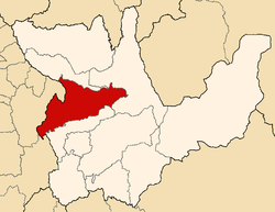 Location of Huamalíes in the Huánuco Region | |
| Country | Peru |
| Region | Huánuco |
| Capital | Llata |
| Government | |
| • Mayor | Eduardo Grover Quino Herrera |
| Area | |
| • Total | 3,144.50 km2 (1,214.10 sq mi) |
| Population (2005 census) | |
| • Total | 68,809 |
| • Density | 22/km2 (57/sq mi) |
| UBIGEO | 1005 |
The Huamalíes Province is one of eleven provinces of the Huánuco Region in Peru. The capital of this province is the city of Llata.
YouTube Encyclopedic
-
1/1Views:7 742
-
LIRIOS DE LLATA - Entrevista a los valuartes del arpa & violin Huamaliano
Transcription
Boundaries
- North: Huacaybamba Province
- East: Leoncio Prado Province
- South: Dos de Mayo Province
- West: Ancash Region
Geography
Some of the highest mountains of the province are listed below:[1]
- Artisa Ukru
- Kuntur Wank'a
- Mama Hirka
- Marayniyuq
- Millpu
- Millwa Pillu
- Pawqar
- Puma Wayin
- Putka
- P'itiq Punta
- Qaqa Mach'ay
- Qucha Qaqa
- Susupillu
- Tinyaq
- Tumaq Hirka
- Ushnu
- Ushnu Rumi
- Wamash Punta
- Warmi Wañusqa
- Wirush
Political division
The province is divided into eleven districts, which are:
- Arancay (Arancay)
- Chavín de Pariarca (Chavín de Pariarca)
- Jacas Grande (Jacas Grande)
- Jircan (Jircan)
- Llata (Llata)
- Miraflores (Miraflores)
- Monzón (Monzón)
- Punchao (Punchao)
- Puños (Puños)
- Singa (Singa)
- Tantamayo (Tantamayo)
Ethnic groups
The people in the province are mainly indigenous citizens of Quechua descent. Quechua is the language which the majority of the population (53.30%) learnt to speak in childhood, 46.23% of the residents started speaking using the Spanish language (2007 Peru Census).[2]
Archaeology
Some of the most important archaeological sites of the province are Anku, Awila Qhincha Mach'ay, Awkin Punta, Awqa Punta, Isuq, K'ipakhara, Miyu Pampa, Phiruru, Pumaq Hirka, Qillqay Mach'ay, Susupillu, Urpish, Wanqaran and Wat'a, some of which were declared a National Cultural Heritage.[3]
See also
References
- ^ escale.minedu.gob.pe - UGEL map of the Huamalíes Province (Huánuco Region)
- ^ inei.gob.pe Archived 2013-01-27 at the Wayback Machine INEI, Peru, Censos Nacionales 2007
- ^ "Bùsqueda". mincetur. Archived from the original on June 8, 2016. Retrieved May 31, 2016.
| |
|---|---|
| International | |
|---|---|
| National | |
9°32′59″S 76°49′01″W / 9.549620°S 76.816921°W
This Huánuco Region geography article is a stub. You can help Wikipedia by expanding it. |