
Kamerik | |
|---|---|
Town | |
 | |
 Coat of arms | |
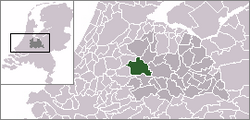 | |
 The village of Kamerik (dark green) and the statistical district "Kamerik and Kanis" (light green) in the municipality of Woerden. | |
| Coordinates: 52°6′39″N 4°53′34″E / 52.11083°N 4.89278°E | |
| Country | Netherlands |
| Province | Utrecht |
| Municipality | Woerden |
| Population (1 January 2010) | |
| • Total | 3,808 |
| Time zone | UTC+1 (CET) |
| • Summer (DST) | UTC+2 (CEST) |
Kamerik is a village in the Dutch province of Utrecht. It is a part of the municipality of Woerden and is situated about 3 km north of Woerden.
In 2010 the village of Kamerik (including Kanis) had 3808 inhabitants. The built-up area of the town was 0.43 km² and contained 877 residences.[1] The statistical district "Kamerik and Kanis", which includes two villages and the surrounding countryside, has a population of around 3050.[2] This does not include the separate villages of Kamerik-Mijzijde and Oud-Kamerik.
Until it was merged with Woerden in 1989 Kamerik was a separate municipality. Between 1818 and 1857 it was split into two municipalities: Kamerik-Mijzijde on the west side, and Kamerik-Houtdijken on the east.[3]
YouTube Encyclopedic
-
1/1Views:1 863
-
Helikoptervlucht kamerik kockengen scharelslager zwetsloot koninginnendag 2011
Transcription
References
- ^ Statistics Netherlands (CBS), Bevolkingskernen in Nederland 2001 [1]. Statistics are for the continuous built-up area.
- ^ Statistics Netherlands (CBS), Statline: Kerncijfers wijken en buurten 2003-2005 [2]. As of January 1, 2005.
- ^ Ad van der Meer and Onno Boonstra, "Repertorium van Nederlandse gemeenten", KNAW, 2006. "KNAW > Publicaties > Detailpagina". Archived from the original on 2007-02-20. Retrieved 2009-12-03.
| International | |
|---|---|
| National | |
This Utrecht location article is a stub. You can help Wikipedia by expanding it. |