To install click the Add extension button. That's it.

The source code for the WIKI 2 extension is being checked by specialists of the Mozilla Foundation, Google, and Apple. You could also do it yourself at any point in time.

4,5
Kelly Slayton
Congratulations on this excellent venture… what a great idea!
Alexander Grigorievskiy
I use WIKI 2 every day and almost forgot how the original Wikipedia looks like.
Live Statistics
English Articles
Improved in 24 Hours
Added in 24 Hours
Languages
Recent
Show all languages
What we do. Every page goes through several hundred of perfecting techniques; in live mode. Quite the same Wikipedia. Just better.
.
Leo
Newton
Brights
Milds

List of lighthouses in Ireland

From Wikipedia, the free encyclopedia

Fanad lighthouse

This is a list of lighthouses in Ireland. The Commissioners of Irish Lights are responsible for the majority of marine navigation aids around the island though a small number are maintained by local harbour authorities. The main list identifies those lighthouses in a clockwise direction starting with Crookhaven lighthouse, County Cork.[1][2][3][4][5]

YouTube Encyclopedic

  • 1/4
    Views:
    3 780 767
    4 334
    46 502
    25 299
  • Most ISOLATED Homes Around The World!
  • Sextant to Line of Position - A Complete Sight Reduction from an Offshore Sailing Race
  • Top 10 Mysterious Objects People Need To Give Away
  • MBA in Ireland for international students

Transcription

Maintained by Commissioners of Irish Lights

Name Image Location
Coordinates
County Water body Year built Tower height Focal height Range
Crookhaven Lighthouse
Crookhaven
51°28′37″N 9°42′18″W / 51.477°N 9.705°W / 51.477; -9.705
Cork Celtic Sea 1843 14 m (46 ft) 20 m (66 ft) 13 nmi (24 km)
Mizen Head Lighthouse
Mizen Head
51°27′N 9°49′W / 51.45°N 9.82°W / 51.45; -9.82
Cork Celtic Sea 1959 4 m (13 ft) 55 m (180 ft) 15 nmi (28 km)
Roancarrigmore Lighthouse
Roancarrigmore Island
51°39′11″N 9°44′49″W / 51.653°N 9.747°W / 51.653; -9.747
Cork Bantry Bay 1847 7 m (23 ft) 18 m (59 ft) 11 nmi (20 km)
Castletownbere Light
Castletownbere
51°38′49″N 9°54′18″W / 51.647°N 9.905°W / 51.647; -9.905
Cork Bantry Bay 1965 5 m (16 ft) 7 m (23 ft) 15 nmi (28 km)
Ardnakinna Lighthouse
Bere Island
51°37′05″N 9°55′05″W / 51.618°N 9.918°W / 51.618; -9.918
Cork Bantry Bay 1850/1965 20 m (66 ft) 62 m (203 ft) 17 nmi (31 km)
Sheep's Head Lighthouse
Sheep's Head
51°32′35″N 9°50′56″W / 51.543°N 9.849°W / 51.543; -9.849
Cork Bantry Bay 1968 7 m (23 ft) 83 m (272 ft) 18 nmi (33 km)
Bull Rock Lighthouse
Bull Rock
51°35′31″N 10°18′04″W / 51.592°N 10.301°W / 51.592; -10.301
Cork North Atlantic 1889 15 m (49 ft) 91 m (299 ft) 18 nmi (33 km)
Skelligs Lighthouse
Skellig Michael
51°46′05″N 10°32′31″W / 51.768°N 10.542°W / 51.768; -10.542
Kerry North Atlantic 1826/1967 12 m (39 ft) 53 m (174 ft) 12 nmi (22 km)
Valentia Light Valentia Island
51°55′30″N 10°18′25″W / 51.925°N 10.307°W / 51.925; -10.307
Kerry North Atlantic 1913 6 m (20 ft) 25 m (82 ft) 11 nmi (20 km)
Cromwell Point Lighthouse
Valentia Island
51°56′02″N 10°19′16″W / 51.934°N 10.321°W / 51.934; -10.321
Kerry North Atlantic 1841 15 m (49 ft) 16 m (52 ft) 17 nmi (31 km)
Inishtearaght Lighthouse
Tearaght Island
52°04′34″N 10°39′40″W / 52.076°N 10.661°W / 52.076; -10.661
Kerry North Atlantic 1870 17 m (56 ft) 84 m (276 ft) 19 nmi (35 km)
Little Samphire Island Lighthouse
Fenit
52°16′16″N 9°52′55″W / 52.271°N 9.882°W / 52.271; -9.882
Kerry Tralee Bay 1854 12 m (39 ft) 17 m (56 ft) 14 nmi (26 km)
Inis Cathaig Lighthouse
Scattery Island
52°36′22″N 9°31′05″W / 52.606°N 9.518°W / 52.606; -9.518
Clare Shannon 1872 12 m (39 ft) 15 m (49 ft) 10 nmi (19 km)
Corlis Point rear (Querrin Quay) leading light
CorlisPointLeadingLight
Carrigaholt
52°37′41″N 9°35′20″W / 52.628°N 9.589°W / 52.628; -9.589
Clare Shannon 1998 25 m (82 ft) 27 m (89 ft) 10 nmi (19 km)
Corlis Point front leading light
Carrigaholt
52°37′05″N 9°36′22″W / 52.618°N 9.606°W / 52.618; -9.606
Clare Shannon 1998 4 m (13 ft) 9 m (30 ft) 10 nmi (19 km)
Loop Head
Loop Head
52°33′40″N 9°55′55″W / 52.561°N 9.932°W / 52.561; -9.932
Clare North Atlantic 1854 23 m (75 ft) 84 m (276 ft) 23 nmi (43 km)
Inisheer Lighthouse
Inisheer
53°02′49″N 9°31′37″W / 53.047°N 9.527°W / 53.047; -9.527
Galway North Atlantic 1857 34 m (112 ft) 34 m (112 ft) 20 nmi (37 km)
Black Head Lighthouse, County Clare
Fanore
53°09′14″N 9°15′50″W / 53.154°N 9.264°W / 53.154; -9.264
Clare Galway Bay 1936 8 m (26 ft) 20 m (66 ft) 11 nmi (20 km)
Cashla Bay Lighthouse
Casla
53°15′50″N 9°33′58″W / 53.264°N 9.566°W / 53.264; -9.566
Galway Galway Bay 1984 4 m (13 ft) 6 m (20 ft) 8 nmi (15 km)
Straw Island Lighthouse
Aran Islands
53°07′05″N 9°37′52″W / 53.118°N 9.631°W / 53.118; -9.631
Galway North Atlantic 1878 11 m (36 ft) 11 m (36 ft) 15 nmi (28 km)
Eeragh Lighthouse
Aran Islands
53°08′53″N 9°51′25″W / 53.148°N 9.857°W / 53.148; -9.857
Galway North Atlantic 1857 31 m (102 ft) 35 m (115 ft) 18 nmi (33 km)
Slyne Head Lighthouse
Slyne Head lighthouse
53°24′00″N 10°14′02″W / 53.4°N 10.234°W / 53.4; -10.234
Galway North Atlantic 1836 24 m (79 ft) 35 m (115 ft) 19 nmi (35 km)
Inishgort Lighthouse
Clew Bay
53°49′37″N 9°40′16″W / 53.827°N 9.671°W / 53.827; -9.671
Mayo Clew Bay 1827 8 m (26 ft) 11 m (36 ft) 10 nmi (19 km)
Achillbeg Lighthouse
Achillbeg
53°51′29″N 9°56′49″W / 53.858°N 9.947°W / 53.858; -9.947
Mayo Clew Bay 1965 9 m (30 ft) 56 m (184 ft) 18 nmi (33 km)
Blacksod Lighthouse
Blacksod Bay
54°05′56″N 10°03′36″W / 54.099°N 10.06°W / 54.099; -10.06
Mayo North Atlantic 1864 12 m (39 ft) 13 m (43 ft) 12 nmi (22 km)
Blackrock Mayo Lighthouse
Blacksod Bay
54°04′05″N 10°19′16″W / 54.068°N 10.321°W / 54.068; -10.321
Mayo North Atlantic 1864 15 m (49 ft) 86 m (282 ft) 20 nmi (37 km)
Eagle Island lighthouse
Eagle Island
54°17′02″N 10°05′35″W / 54.284°N 10.093°W / 54.284; -10.093
Mayo North Atlantic 1835 11 m (36 ft) 67 m (220 ft) 18 nmi (33 km)
Broadhaven Lighthouse
Broadhaven Bay
54°16′05″N 9°53′20″W / 54.268°N 9.889°W / 54.268; -9.889
Mayo North Atlantic 1848 15 m (49 ft) 27 m (89 ft) 17 nmi (31 km)
Oyster Island Lighthouse
Rosses Point
54°18′07″N 8°34′16″W / 54.302°N 8.571°W / 54.302; -8.571
Sligo Sligo Bay 1837/1893 12 m (39 ft) 13 m (43 ft) 7 nmi (13 km)
Metal Man Sligo Lighthouse
Rosses Point
54°18′14″N 8°34′34″W / 54.304°N 8.576°W / 54.304; -8.576
Sligo Sligo Bay 1821 5 m (16 ft) 3 m (10 ft) 7 nmi (13 km)
Lower Rosses Lighthouse
Rosses Point
54°19′44″N 8°34′23″W / 54.329°N 8.573°W / 54.329; -8.573
Sligo Sligo Bay 1908 8 m (26 ft) 8 m (26 ft) 13 nmi (24 km)
Blackrock Sligo Lighthouse
Sligo Bay
54°18′29″N 8°37′05″W / 54.308°N 8.618°W / 54.308; -8.618
Sligo Sligo Bay 1835 25 m (82 ft) 24 m (79 ft) 10 nmi (19 km)
Rotten Island lighthouse
Rotten Island
54°36′54″N 8°26′28″W / 54.615°N 8.441°W / 54.615; -8.441
Donegal Donegal Bay 1838 14 m (46 ft) 20 m (66 ft) 15 nmi (28 km)
St John's Point Lighthouse, County Donegal
Dunkineely
54°34′08″N 8°27′40″W / 54.569°N 8.461°W / 54.569; -8.461
Donegal Donegal Bay 1831 14 m (46 ft) 30 m (98 ft) 14 nmi (26 km)
Rathlin O'Birne Lighthouse
Glencolmcille
54°39′50″N 8°49′59″W / 54.664°N 8.833°W / 54.664; -8.833
Donegal North Atlantic 1856 20 m (66 ft) 35 m (115 ft) 12 nmi (22 km)
Ballagh Rocks Lighthouse
Arranmore
54°59′56″N 8°28′52″W / 54.999°N 8.481°W / 54.999; -8.481
Donegal North Atlantic 1982 10 m (33 ft) 13 m (43 ft) 5 nmi (9 km)
Arranmore Lighthouse
Arranmore
55°00′54″N 8°33′40″W / 55.015°N 8.561°W / 55.015; -8.561
Donegal North Atlantic 1798/1865 23 m (75 ft) 71 m (233 ft) 27 nmi (50 km)
Tory Island Lighthouse
Tory Island
55°16′23″N 8°14′56″W / 55.273°N 8.249°W / 55.273; -8.249
Donegal North Atlantic 1832 27 m (89 ft) 40 m (131 ft) 18 nmi (33 km)
Buncrana Light
Buncrana
55°07′37″N 7°27′54″W / 55.127°N 7.465°W / 55.127; -7.465
Donegal Lough Swilly 1876/2009 6 m (20 ft) 11 m (36 ft) 13 nmi (24 km)
Dunree Lighthouse
Dunree
55°11′53″N 7°33′14″W / 55.198°N 7.554°W / 55.198; -7.554
Donegal Lough Swilly 1876 6 m (20 ft) 46 m (151 ft) 12 nmi (22 km)
Fanad Head Lighthouse
Fanad
55°16′34″N 7°37′55″W / 55.276°N 7.632°W / 55.276; -7.632
Donegal North Atlantic 1817/1886 22 m (72 ft) 39 m (128 ft) 18 nmi (33 km)
Inishtrahull Lighthouse
Inishtrahull Island
55°25′52″N 7°14′38″W / 55.431°N 7.244°W / 55.431; -7.244
Donegal North Atlantic 1812/1958 23 m (75 ft) 59 m (194 ft) 19 nmi (35 km)
Inishowen Lighthouse
Inishowen
55°13′34″N 6°55′44″W / 55.226°N 6.929°W / 55.226; -6.929
Donegal North Atlantic 1837 23 m (75 ft) 29 m (95 ft) 18 nmi (33 km)
Rathlin West Lighthouse
Rathlin Island
55°18′04″N 6°16′52″W / 55.301°N 6.281°W / 55.301; -6.281
Antrim North Channel 1917 18 m (59 ft) 62 m (203 ft) 22 nmi (41 km)
Rathlin East (Altacarry Head) Lighthouse
Rathlin Island
55°18′07″N 6°10′19″W / 55.302°N 6.172°W / 55.302; -6.172
Antrim North Channel 1856 27 m (89 ft) 74 m (243 ft) 26 nmi (48 km)
Rue Point Lighthouse
Rathlin Island
55°15′32″N 6°11′28″W / 55.259°N 6.191°W / 55.259; -6.191
Antrim North Channel 1915/1921 11 m (36 ft) 16 m (52 ft) 14 nmi (26 km)
Maidens Lighthouse
The Maidens
54°55′44″N 5°43′41″W / 54.929°N 5.728°W / 54.929; -5.728
Antrim North Channel 1829 23 m (75 ft) 29 m (95 ft) 23 nmi (43 km)
Blackhead Lighthouse, County Antrim
Whitehead
54°46′01″N 5°41′20″W / 54.767°N 5.689°W / 54.767; -5.689
Antrim North Channel 1902 16 m (52 ft) 45 m (148 ft) 27 nmi (50 km)
Mew Island Lighthouse
Mew Island
54°41′56″N 5°30′50″W / 54.699°N 5.514°W / 54.699; -5.514
Down North Channel 1884 37 m (121 ft) 37 m (121 ft) 24 nmi (44 km)
Donaghadee Lighthouse
Donaghadee
54°38′42″N 5°31′52″W / 54.645°N 5.531°W / 54.645; -5.531
Down North Channel 1836 16 m (52 ft) 17 m (56 ft) 17 nmi (31 km)
Angus Rock Lighthouse
Strangford Lough
54°19′52″N 5°31′30″W / 54.331°N 5.525°W / 54.331; -5.525
Down Strangford Lough 1983 13 m (43 ft) 15 m (49 ft) 5 nmi (9 km)
St John's Point Lighthouse, County Down
Killough
54°13′37″N 5°39′36″W / 54.227°N 5.66°W / 54.227; -5.66
Down Irish Sea 1844/1893 39 m (128 ft) 37 m (121 ft) 25 nmi (46 km)
Green Island Leading Light
Carlingford Lough
54°01′59″N 6°05′46″W / 54.033°N 6.096°W / 54.033; -6.096
Down Carlingford Lough 1873 14 m (46 ft) 13 m (43 ft) 11 nmi (20 km)
Vidal Bank Leading Light
Carlingford Lough
54°01′48″N 6°05′28″W / 54.03°N 6.091°W / 54.03; -6.091
Down Carlingford Lough 1873 8 m (26 ft) 7 m (23 ft) 11 nmi (20 km)
Haulbowline Lighthouse
Carlingford Lough
54°01′12″N 6°04′44″W / 54.02°N 6.079°W / 54.02; -6.079
Down Irish Sea 1824 34 m (112 ft) 32 m (105 ft) 10 nmi (19 km)
Dundalk Lighthouse
Dundalk
53°58′34″N 6°17′42″W / 53.976°N 6.295°W / 53.976; -6.295
Louth Irish Sea 1855 10 m (33 ft) 10 m (33 ft) 10 nmi (19 km)
Rockabill Lighthouse
Rockabill
53°35′49″N 6°00′18″W / 53.597°N 6.005°W / 53.597; -6.005
Dublin Irish Sea 1860 32 m (105 ft) 45 m (148 ft) 18 nmi (33 km)
Baily Lighthouse
Howth Head
53°21′43″N 6°03′11″W / 53.362°N 6.053°W / 53.362; -6.053
Dublin Dublin Bay 1814 13 m (43 ft) 41 m (135 ft) 18 nmi (33 km)
Dún Laoghaire West Lighthouse
Dún Laoghaire
53°18′11″N 6°07′52″W / 53.303°N 6.131°W / 53.303; -6.131
Dublin Dublin Bay 1852 9 m (30 ft) 11 m (36 ft) 7 nmi (13 km)
Dún Laoghaire East Lighthouse
Dún Laoghaire
53°18′11″N 6°07′37″W / 53.303°N 6.127°W / 53.303; -6.127
Dublin Dublin Bay 1847 12 m (39 ft) 16 m (52 ft) 17 nmi (31 km)
Muglins Lighthouse
Dalkey Island
53°16′30″N 6°04′34″W / 53.275°N 6.076°W / 53.275; -6.076
Dublin Dublin Bay 1906 9 m (30 ft) 14 m (46 ft) 11 nmi (20 km)
Kish Lighthouse
Kish Bank
53°18′40″N 5°55′34″W / 53.311°N 5.926°W / 53.311; -5.926
Dublin Dublin Bay 1965 31 m (102 ft) 29 m (95 ft) 22 nmi (41 km)
Wicklow Head Lighthouse
Wicklow Head
52°57′58″N 5°59′53″W / 52.966°N 5.998°W / 52.966; -5.998
Wicklow St George's Channel 1781/1818 14 m (46 ft) 37 m (121 ft) 23 nmi (43 km)
Tuskar Rock Lighthouse
Tuskar Rock
52°12′11″N 6°12′25″W / 52.203°N 6.207°W / 52.203; -6.207
Wexford St George's Channel 1815 34 m (112 ft) 33 m (108 ft) 24 nmi (44 km)
Dunmore East Lighthouse
Dunmore East
52°08′56″N 6°59′24″W / 52.149°N 6.99°W / 52.149; -6.99
Waterford Celtic Sea 1825 16 m (52 ft) 13 m (43 ft) 17 nmi (31 km)
Hook Lighthouse
Hook Head
52°07′26″N 6°55′48″W / 52.124°N 6.93°W / 52.124; -6.93
Wexford Celtic Sea 1172 35 m (115 ft) 46 m (151 ft) 23 nmi (43 km)
Ballinacourty Point Lighthouse
Dungarvan
52°04′41″N 7°33′11″W / 52.078°N 7.553°W / 52.078; -7.553
Waterford Celtic Sea 1858 13 m (43 ft) 16 m (52 ft) 10 nmi (19 km)
Mine Head Lighthouse
Mine Head
51°59′35″N 7°35′13″W / 51.993°N 7.587°W / 51.993; -7.587
Waterford Celtic Sea 1851 21 m (69 ft) 87 m (285 ft) 12 nmi (22 km)
Ballycotton lighthouse
Ballycotton
51°49′30″N 7°59′10″W / 51.825°N 7.986°W / 51.825; -7.986
Cork Celtic Sea 1851 15 m (49 ft) 59 m (194 ft) 21 nmi (39 km)
Roche's Point Lighthouse
Cork Harbour
51°47′35″N 8°15′18″W / 51.793°N 8.255°W / 51.793; -8.255
Cork Cork Harbour 1817/1835 15 m (49 ft) 30 m (98 ft) 20 nmi (37 km)
Charlesfort Lighthouse
Charlesfort
51°41′46″N 8°30′00″W / 51.696°N 8.5°W / 51.696; -8.5
Cork Kinsale Harbour Unknown 5 m (16 ft) 18 m (59 ft) 9 nmi (17 km)
Old Head of Kinsale Lighthouse
Old Head of Kinsale
51°36′18″N 8°32′02″W / 51.605°N 8.534°W / 51.605; -8.534
Cork Celtic Sea 1665/1853 30 m (98 ft) 72 m (236 ft) 20 nmi (37 km)
Galley Head Lighthouse
Galley Head
51°31′48″N 8°57′14″W / 51.53°N 8.954°W / 51.53; -8.954
Cork Celtic Sea 1878 21 m (69 ft) 53 m (174 ft) 23 nmi (43 km)
Copper Point Lighthouse
Long Island
51°30′14″N 9°32′02″W / 51.504°N 9.534°W / 51.504; -9.534
Cork Celtic Sea 1864 15 m (49 ft) 16 m (52 ft) 8 nmi (15 km)
Fastnet Lighthouse
Fastnet Rock
51°23′20″N 9°36′11″W / 51.389°N 9.603°W / 51.389; -9.603
Cork Celtic Sea 1854/1904 54 m (177 ft) 49 m (161 ft) 27 nmi (50 km)

Maintained by other Irish marine authorities

A smaller number of active lighthouses are operated by other authorities, primarily the port and harbour companies located around the Irish coast.[1][2][3][4]

Name Image Location
Coordinates
County Waterbody Built Tower Height Focal Height Operated by
Aleria
Drogheda
53°43′21″N 6°14′20″W / 53.7225°N 6.2388°W / 53.7225; -6.2388 (Aleria)
Louth Irish Sea 1936 10 m (33 ft) 11 m (36 ft) Drogheda Port Company
Ardglass Pier
Ardglass
54°15′40″N 5°36′10″W / 54.2610°N 5.6027°W / 54.2610; -5.6027 (Ardglass Pier)
Down Ardglass Harbour 1885 9.5 m (31 ft) 10 m (33 ft) Northern Ireland Fishery Harbour Authority
Balbriggan
Balbriggan
53°36′46″N 6°10′43″W / 53.6129°N 6.1787°W / 53.6129; -6.1787 (Balbriggan)
Fingal Irish Sea 1769 11 m (36 ft) 12 m (39 ft) Dublin Port Company
Ballynagard
River Foyle
55°02′17″N 7°16′25″W / 55.0380°N 7.2736°W / 55.0380; -7.2736 (Ballynagard)
Londonderry River Foyle Unknown 7 m (23 ft) 6 m (20 ft) Londonderry Port
Barrack Point
Sherkin Island
51°28′22″N 9°23′41″W / 51.4728°N 9.3947°W / 51.4728; -9.3947 (Barrack Point)
Cork Baltimore Harbour 1885 8 m (26 ft) 40 m (131 ft) Cork County Council
Beeves Rock
Shannon Estuary
52°39′01″N 9°01′21″W / 52.6502°N 9.0225°W / 52.6502; -9.0225 (Beeves Rock)
Clare Shannon Estuary 1855 18 m (59 ft) 12 m (39 ft) Shannon Foynes Port Company
Chaine Memorial
Larne
54°51′18″N 5°47′53″W / 54.855°N 5.798°W / 54.855; -5.798 (Chaine)
Antrim North Channel 1899 23 m (75 ft) 23 m (75 ft) Larne Harbour
Dingle Harbour
Dingle
52°07′18″N 10°15′30″W / 52.1216°N 10.2582°W / 52.1216; -10.2582 (Dingle Harbour)
Kerry Dingle Harbour 1885 7 m (23 ft) 20 m (66 ft) Dingle Fishery Harbour Centre
Duncannon Fort
Duncannon Fort
52°13′14″N 6°56′15″W / 52.2205°N 6.9374°W / 52.2205; -6.9374 (Duncannon Fort)
Wexford Waterford Harbour Unknown 7.5 m (25 ft) 13 m (43 ft) Port of Waterford Company
Duncannon North
Duncannon
52°13′45″N 6°56′13″W / 52.2292°N 6.9369°W / 52.2292; -6.9369 (Duncannon North)
Wexford Waterford Harbour 1838 10.5 m (34 ft) 39 m (128 ft) Port of Waterford Company
Galway Harbour (The Leverets)
Galway Harbour
53°15′19″N 9°01′55″W / 53.2554°N 9.0319°W / 53.2554; -9.0319 (Galway Harbour)
Galway Galway Bay 1977 9 m (30 ft) 9 m (30 ft) Galway Harbour Company
Howth Harbour
Howth
53°23′39″N 6°04′01″W / 53.3941°N 6.0669°W / 53.3941; -6.0669 (Howth Harbour)
Fingal Irish Sea 1982 10 m (33 ft) 13 m (43 ft) Dublin Port Company
Moville
Moville
55°10′59″N 7°02′07″W / 55.1831°N 7.0354°W / 55.1831; -7.0354 (Moville)
Donegal Lough Foyle 1882 13.5 m (44 ft) 11 m (36 ft) Londonderry Port
North Bank
Dublin Port
53°20′41″N 6°10′35″W / 53.3448°N 6.1765°W / 53.3448; -6.1765 (North Bank)
Dublin River Liffey 1882 11 m (36 ft) 10 m (33 ft) Dublin Port Company
North Bull
North Bull Island
53°20′42″N 6°08′59″W / 53.3449°N 6.1497°W / 53.3449; -6.1497 (North Bull)
Dublin Dublin Bay 1880 15 m (49 ft) 15 m (49 ft) Dublin Port Company
North Wall Quay
Dublin Port
53°20′45″N 6°12′59″W / 53.3457°N 6.2165°W / 53.3457; -6.2165 (North Wall Quay)
Dublin River Liffey 1904 12 m (39 ft) 12 m (39 ft) Dublin Port Company
Poolbeg
Poolbeg
53°20′32″N 6°09′06″W / 53.3421°N 6.1517°W / 53.3421; -6.1517 (Poolbeg)
Dublin Dublin Bay 1820 20 m (66 ft) 20 m (66 ft) Dublin Port Company
Rosslare Harbour
Rosslare Europort
52°15′26″N 6°20′17″W / 52.2571°N 6.3381°W / 52.2571; -6.3381 (Rosslare Harbour)
Wexford St Georges Channel 1906 7.5 m (25 ft) 15 m (49 ft) Rosslare Europort
Spillane's Tower
Limerick
52°39′21″N 8°39′41″W / 52.6558°N 8.6615°W / 52.6558; -8.6615 (Spillane's Tower)
Limerick River Shannon 1885 11 m (36 ft) 11 m (36 ft) Shannon Foynes Port Company
Spit Bank
Cobh
51°50′43″N 8°16′26″W / 51.8453°N 8.2739°W / 51.8453; -8.2739 (Spit Bank)
Cork Cork Harbour 1853 10.5 m (34 ft) 10 m (33 ft) Port of Cork Company
Tarbert Island
Tarbet
52°35′31″N 9°21′49″W / 52.5920°N 9.3636°W / 52.5920; -9.3636 (Tarbert Island)
Kerry River Shannon 1834 22.5 m (74 ft) 18 m (59 ft) Shannon Foynes Port Company
Warren Point
Greencastle
55°12′35″N 6°57′07″W / 55.2097°N 6.9519°W / 55.2097; -6.9519 (Warren Point)
Donegal Lough Foyle 1861 8 m (26 ft) 9 m (30 ft) Londonderry Port
Wicklow East Pier
Wicklow
52°59′00″N 6°02′04″W / 52.9832°N 6.0344°W / 52.9832; -6.0344 (Wicklow East Pier)
Wicklow Irish Sea 1884 7 m (23 ft) 11 m (36 ft) Wicklow Port Company
Youghal Lighthouse
Youghal
51°56′35″N 7°50′31″W / 51.943°N 7.842°W / 51.943; -7.842 (Youghal)
Cork Celtic Sea 1852 15 m (49 ft) 24 m (79 ft) Cork County Council

Inactive

Improvements and changes to the aids to navigation around the Irish coast, has meant that there are a number of lighthouses that have been decommissioned. This list includes those where the tower or structure is still in existence. Some of these have been reused, such as Ferris Point which is now a vessel control tower. Clare Island was turned into a guest house and the optic is on permanent rotating display at the World of Glass museum and visitor centre in North West England. The older Wicklow Head tower was refurbished by the Irish Landmark Trust as a holiday let.[1][2][3][4]

Name Image Location
Coordinates
County Waterbody Built Inactive
since
Notes
Ballycurrin
Headford
53°29′06″N 9°12′47″W / 53.4851°N 9.2130°W / 53.4851; -9.2130 (Ballycurrin)
Mayo Lough Corrib 1847 Unknown Unusual lakeshore light with external staircase.[4]
Blackrock Castle
Cork
51°54′00″N 8°24′09″W / 51.9000°N 8.4025°W / 51.9000; -8.4025 (Blackrock Castle)
Cork Cork Harbour 1582 1903 A light was shown from a window in the highest tower.[3]
Calf Rock
Dursey Island
51°35′06″N 10°16′35″W / 51.5850°N 10.2763°W / 51.5850; -10.2763 (Calf Rock)
Cork North Atlantic 1866 1881 The tower was badly damaged by a storm in 1881.[3]
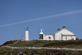
Cape Clear
Cape Clear Island
51°26′04″N 9°29′05″W / 51.4345°N 9.4846°W / 51.4345; -9.4846 (Cape Clear)
Cork Celtic Sea 1818 1854 Deactivated after the original Fastnet lighthouse was completed.[3]
Clare Island
Clare Island
53°49′39″N 9°59′00″W / 53.8275°N 9.9834°W / 53.8275; -9.9834 (Clare Island)
Mayo Clew Bay 1818 1965 Refurbished as a guest house.[4]
Culmore Point
Culmore
55°02′47″N 7°15′15″W / 55.0464°N 7.2541°W / 55.0464; -7.2541 (Culmore Point)
Londonderry River Foyle 1920s 2012 White and green tower next to Culmore Fort. Replaced by a post light.[1]
Drogheda East
Mornington
53°43′09″N 6°14′51″W / 53.7192°N 6.2476°W / 53.7192; -6.2476 (Drogheda East)
Meath River Boyne 1880s 2007 One of three lights constructed to aid navigation along the Boyne and into the harbour at Drogheda.[2]
Drogheda North
Mornington
53°43′27″N 6°15′16″W / 53.7241°N 6.2544°W / 53.7241; -6.2544 (Drogheda North)
Meath River Boyne 1880s 2000 One of three lights constructed to aid navigation along the Boyne and into the harbour at Drogheda.[2]
Drogheda West
Mornington
53°43′08″N 6°14′56″W / 53.7189°N 6.2489°W / 53.7189; -6.2489 (Drogheda West)
Meath River Boyne 1880s 2000 One of three lights constructed to aid navigation along the Boyne and into the harbour at Drogheda.[2]
Ferris Point
Larne
54°51′05″N 5°47′24″W / 54.8514°N 5.7900°W / 54.8514; -5.7900 (Ferris Point)
Antrim Larne Lough Unknown 1994 Now houses the control room for the Port of Larne.[1]
Greenore
Greenore
54°02′01″N 6°07′56″W / 54.0337°N 6.1322°W / 54.0337; -6.1322 (Greenore)
Louth Carlingford Lough 1830 1986 Located on Carlingford Lough next to Greenore Port.[2]
Howth Harbour
Howth
53°23′36″N 6°04′00″W / 53.3933°N 6.0668°W / 53.3933; -6.0668 (Howth Harbour)
Fingal Irish Sea 1818 1982 Replaced by modern light nearby.[2]
Inishmore
Inishmore
53°07′39″N 9°42′08″W / 53.1274°N 9.7022°W / 53.1274; -9.7022 (Inishmore)
Galway Galway Bay 1818 1857 The first lighthouse in the Aran Islands, built on the highest point of Inishmore.[4]
Inishowen East
Inishowen
55°13′36″N 6°55′38″W / 55.2266°N 6.9271°W / 55.2266; -6.9271 (Inishowen East)
Donegal North Channel 1837 1961 Squat tower separate from the active West Inishowen Lighthouse.[4]
Kilcredaun Head
Carrigaholt
52°34′47″N 9°42′35″W / 52.5798°N 9.7097°W / 52.5798; -9.7097 (Kilcredaun Head)
Clare Shannon Estuary 1824 2011 Positioned on a headland on the northern shore of the estuary.[3]
Mutton Island
Mutton Island
53°15′15″N 9°03′13″W / 53.2541°N 9.0535°W / 53.2541; -9.0535 (Mutton Island)
Galway Galway Bay 1817 1977 Replaced by the Galway Harbour lighthouse. Restored between 2005 and 2011.[4]
Skelling Michael (High) Skelling Michael
51°46′13″N 10°32′38″W / 51.7702°N 10.5438°W / 51.7702; -10.5438 (Skelling Michael (High))
Kerry North Atlantic 1826 1870 Built on a high ledge on the western flank of Skelling Michael.[3]
South Rock (Kilwarlin)
Kearney
54°24′11″N 5°23′00″W / 54.4030°N 5.3833°W / 54.4030; -5.3833 (South Rock (Kilwarlin))
Down North Channel 1797 1877 Considered to be the "oldest surviving waveswept lighthouse in Ireland".[1]
West Maidens
The Maidens
54°59′45″N 5°42′49″W / 54.9957°N 5.7136°W / 54.9957; -5.7136 (West Maidens)
Antrim North Channel 1829 1903 Built at the same time as the East Maidens light.[1]
Wicklow Head High (1781)
Wicklow Head
52°57′55″N 6°00′09″W / 52.9652°N 6.0025°W / 52.9652; -6.0025 (Wicklow Head High (1781))
Wicklow St George's Channel 1781 1818 Octagonal tower, renovated as a holiday let by the Irish Landmark Trust in 1996.[2]
Wicklow Head High (1818)
Wicklow Head
52°57′56″N 6°00′02″W / 52.9655°N 6.0005°W / 52.9655; -6.0005 (Wicklow Head High (1818))
Wicklow St George's Channel 1818 1865 Round tower, built to complement the currently active low level light.[2]

Other

See also

References

  1. ^ a b c d e f g Rowlett, Russ. "Lighthouses of Northern Ireland". The Lighthouse Directory. University of North Carolina at Chapel Hill. Retrieved 21 July 2015.
  2. ^ a b c d e f g h i j Rowlett, Russ. "Lighthouses of Eastern Ireland (Leinster)". The Lighthouse Directory. University of North Carolina at Chapel Hill. Retrieved 21 July 2015.
  3. ^ a b c d e f g h Rowlett, Russ. "Lighthouses of Southwestern Ireland (Munster)". The Lighthouse Directory. University of North Carolina at Chapel Hill. Retrieved 21 July 2015.
  4. ^ a b c d e f g h Rowlett, Russ. "Lighthouses of Western Ireland (Ulster and Connacht)". The Lighthouse Directory. University of North Carolina at Chapel Hill. Retrieved 21 July 2015.
  5. ^ List of Lights, Pub. 114: British Isles, English Channel and North Sea (PDF). List of Lights. United States National Geospatial-Intelligence Agency. 2015. p. 92.

External links

This page was last edited on 7 September 2023, at 14:02
Basis of this page is in Wikipedia. Text is available under the CC BY-SA 3.0 Unported License. Non-text media are available under their specified licenses. Wikipedia® is a registered trademark of the Wikimedia Foundation, Inc. WIKI 2 is an independent company and has no affiliation with Wikimedia Foundation.