

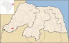
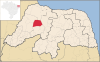
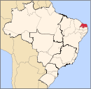
Rio Grande do Norte (English: Great River of the North)[1] is a state located in the Northeast Region of Brazil. According to the 2010 Census conducted by the Brazilian Institute of Geography and Statistics (IBGE), Rio Grande do Norte has a population of 3,168,133 inhabitants over 52,797 square kilometres (20,385 sq mi), which makes it the 16th largest state by population and the 22nd largest by area, out of 26 states.[2][3][4][5] It is home to cities such as Natal, Mossoró, and São Gonçalo do Amarante.
The land that became Rio Grande do Norte was a donatário to João de Barros, the factor of the House of India and Mina, from John III of Portugal in 1535;[6] prior to that, the Portuguese Crown owned the land.[7] The French, who trafficked Brazil wood in the area, had a foothold on the land until the Portuguese expelled them in 1598.[6] The Dutch took the land in 1634 as a part of Dutch Brazil and reigned until 1654, when they were defeated by the Portuguese.[8] In 1701, Rio Grande do Norte joined the Captaincy of Pernambuco, and became a province in 1822 and a state of Brazil in 1889.[6]
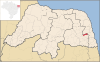
Rio Grande do Norte is divided into 167 municipalities, which are grouped into four mesoregions and 23 microregions. Of the 167 municipalities, Natal has the highest population, with 803,811 inhabitants, while Viçosa, with 1,618 inhabitants, has the lowest. The largest municipality by area is Mossoró, with an area of 2,110 square kilometres (815 sq mi); the smallest is Senador Georgino Avelino, named after the former Senator and Rio Grande do Norte Governor José Georgino Avelino,[9] which covers an area of 26 square kilometres (10 sq mi).
YouTube Encyclopedic
-
1/5Views:49020 865 009988 09411 51638 262
-
Defining the U.S. Southwest - El Norte Region
-
8. The Sumerians - Fall of the First Cities
-
10 Places in NEW YORK You Should NEVER Move To
-
🌞Regions of Brazil: States, Capitals, Data and Statistics | #BrazilWithRicardo
-
A MENOR x MAIOR CIDADE de CADA ESTADO do Brasil em ÁREA
Transcription
Municipalities
-

-
 Pico do Cabugi, an extinct volcano in Angicos
 -
 The Piranhas River in Macau
 -
 Natal, the capital of Rio Grande do Norte
 -
 Parelhas celebrating the 150th anniversary of its founding
 -


See also
References
- ^ Smith, Benjamin Eli (1918). The Century cyclopedia of names: a pronouncing and etymological dictionary of names in geography, biography, mythology, history, ethnology, art, archaeology, fiction, etc., etc. Vol. 6. The Century Company. p. 857.
- ^ "Censo 2010: população do Brasil é de 190.732.694 pessoas" [Census 2010: Brazil's population is 190,732,694 people] (in Portuguese). Brazilian Institute of Geography and Statistics. Archived from the original on 18 January 2012. Retrieved 26 November 2011.
- ^ "Área Territorial Oficial" [Official Territorial Area] (in Portuguese). Brazilian Institute of Geography and Statistics. Archived from the original on 27 June 2012. Retrieved 26 November 2011.
- ^ a b "Censo 2010– Rio Grande do Norte" [Census 2010– Rio Grande do Norte] (PDF) (in Portuguese). Brazilian Institute of Geography and Statistics. 29 November 2010. Archived from the original (PDF) on 14 June 2011. Retrieved 26 November 2011.
- ^ a b "Divisão Territorial do Brasil" [Territorial Divisions of Brazil] (Zip file) (in Portuguese). Brazilian Institute of Geography and Statistics. 1 July 2008. Retrieved 26 November 2011.
- ^ a b c "História" [History] (in Portuguese). State Government of Rio Grande do Norte. Archived from the original on 22 March 2012. Retrieved 10 March 2012.
- ^ Olson, James Stuart; Shadle, Robert (1991). Historical Dictionary of European Imperialism. Greenwood Publishing Group. p. 527. ISBN 978-0-313-26257-9.
- ^ "Paraíba & Rio Grande do Norte" (PDF). Lonely Planet. Archived from the original (PDF) on 2 October 2012. Retrieved 10 March 2012.
- ^ "Senador Georgino Avelino" (in Portuguese). Portal Oficial De Turismo do Rio Grande do Norte. Archived from the original on 2 April 2015. Retrieved 6 March 2015.
- ^ "São Miguel do Gostoso entra na onda do kitesurf" [São Miguel do Gostoso enters the wave of the kite]. Paraná Online (in Portuguese). 23 August 2008. Archived from the original on 4 March 2016. Retrieved 16 March 2012.
- ^ "Rio Grande do Norte" (in Portuguese). Empresa Brasileira de Pesquisa Agropecuária. Archived from the original on 28 March 2013. Retrieved 18 February 2012.
- ^ a b "DTB_2016_v2.zip" (Zip file) (in Portuguese). Brazilian Institute of Geography and Statistics. Retrieved 22 April 2020. DTB_BRASIL_MUNICIPIO.xls within zip file.
Capital: Natal | |||||||||||||||
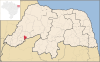
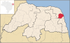
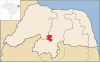
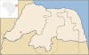
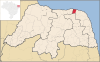
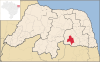
| Mesoregion Agreste Potiguar |
|  | |||||||||||||
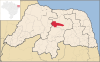
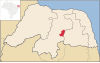
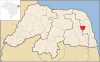
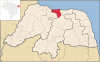
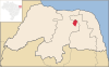
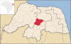
| Mesoregion Central Potiguar |
| ||||||||||||||
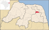
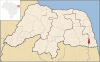
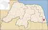
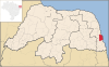
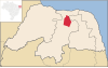
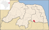
| Mesoregion Leste Potiguar |
| ||||||||||||||
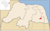
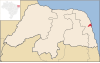
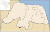
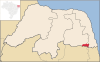
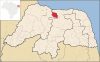
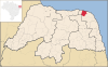
| Mesoregion Oeste Potiguar |
| ||||||||||||||