To install click the Add extension button. That's it.
The source code for the WIKI 2 extension is being checked by specialists of the Mozilla Foundation, Google, and Apple. You could also do it yourself at any point in time.
How to transfigure the Wikipedia
Would you like Wikipedia to always look as professional and up-to-date? We have created a browser extension. It will enhance any encyclopedic page you visit with the magic of the WIKI 2 technology.
Try it — you can delete it anytime.
Install in 5 seconds
Yep, but later
4,5
Kelly Slayton
Congratulations on this excellent venture… what a great idea!
Alexander Grigorievskiy
I use WIKI 2 every day and almost forgot how the original Wikipedia looks like.
Live Statistics
English Articles
Improved in 24 Hours
Added in 24 Hours
What we do. Every page goes through several hundred of perfecting techniques; in live mode. Quite the same Wikipedia. Just better.
A map of the United States when the Territory of Colorado was created on February 28, 1861.
This is a partial list of trading posts that existed in the area of the present U.S.State of Colorado from 1828 to approximately 1868. The 24 historic trading posts in Colorado traded goods produced outside the region to Native Americans for furs, food, and locally made goods. Trading posts also sold goods to travellers and settlers.
This is a sortable table of some of the historic trading posts in Colorado. Select the OpenStreetMap link in the box at right to view a map showing the location these trading posts.


 Reconstruction of Bent's Old Fort.
 Reconstruction of Fort Vasquez.
 Marker at site of Fort Saint Vrain.
 Sketch of Fort Lupton.
 Sketch of Bent's New Fort.
 A map of the United States from 1828 to 1834.
 A map of the United States in 1836.
 A map of the United States from 1845 to 1846.
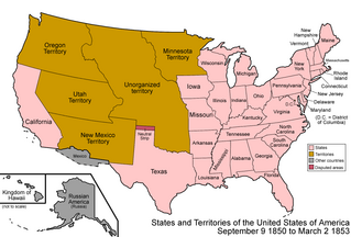 A map of the United States from 1850 to 1853.
 A map of the United States from 1854 to 1858.
 A map of the United States in 1861.
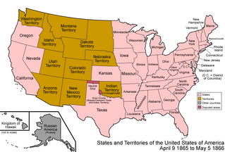 A map of the United States from 1865 to 1866.
 A map of the United States from 1867 to 1868.


 Media from Commons
 News from Wikinews
 Quotations from Wikiquote
 Travel information from Wikivoyage