
Lyons, Georgia | |
|---|---|
 Lyons City Hall | |
 Flag  Seal | |
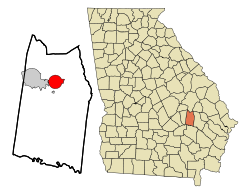 Location in Toombs County and the state of Georgia | |
| Coordinates: 32°12′15″N 82°19′22″W / 32.20417°N 82.32278°W | |
| Country | United States |
| State | Georgia |
| County | Toombs |
| Area | |
| • Total | 8.20 sq mi (21.24 km2) |
| • Land | 8.01 sq mi (20.75 km2) |
| • Water | 0.19 sq mi (0.49 km2) |
| Elevation | 240 ft (73 m) |
| Population (2020) | |
| • Total | 4,239 |
| • Density | 529.15/sq mi (204.31/km2) |
| Time zone | UTC-5 (Eastern (EST)) |
| • Summer (DST) | UTC-4 (EDT) |
| ZIP code | 30436 |
| Area code | 912 |
| FIPS code | 13-48232[2] |
| GNIS feature ID | 0317505[3] |
| Website | lyonsga |
Lyons is a city in Toombs County, Georgia, United States. The population was 4,239 in 2020. The city is the county seat of Toombs County.[4]
YouTube Encyclopedic
-
1/2Views:1 062612
-
2016 Soap Box Derby, Lyons, GA
-
Uvalda community choir at St.Luke AME Lyons Georgia 8/01/2015
Transcription
History
Lyons was founded c. 1890 as a depot on the Central of Georgia Railway. The community was named after one Mr. Lyons, a railroad official.[5] It was incorporated on December 9, 1897.[6] In 1905, Lyons was designated seat of the newly formed Toombs County.[7]
Geography
Lyons is located at 32°12′15″N 82°19′22″W / 32.20417°N 82.32278°W (32.204287, -82.322732).[8]
The city is located at the junction of U.S. Routes 1 and 280. U.S. 1 runs north-south through the center of town, leading north 12 mi (19 km) to Oak Park just south of its junction with Interstate 16 and south 31 mi (50 km) to Baxley. U.S. 280 runs east-west through the city as West Liberty Avenue, leading southeast 15 mi (24 km) to Reidsville and west 6 mi (10 km) to Vidalia. Other highways that run through the city include Georgia State Routes 152, 178, and 292.
According to the United States Census Bureau, the city has a total area of 7.5 square miles (19 km2), of which 7.5 square miles (19 km2) is land and 0.04 square miles (0.10 km2) (0.53%) is water.
Demographics
| Race | Num. | Perc. |
|---|---|---|
| White (non-Hispanic) | 2,011 | 47.44% |
| Black or African American (non-Hispanic) | 1,390 | 32.79% |
| Native American | 2 | 0.05% |
| Asian | 22 | 0.52% |
| Pacific Islander | 2 | 0.05% |
| Other/Mixed | 144 | 3.4% |
| Hispanic or Latino | 668 | 15.76% |
| Census | Pop. | Note | %± |
|---|---|---|---|
| 1900 | 534 | — | |
| 1910 | 927 | 73.6% | |
| 1920 | 873 | −5.8% | |
| 1930 | 1,445 | 65.5% | |
| 1940 | 1,900 | 31.5% | |
| 1950 | 2,799 | 47.3% | |
| 1960 | 3,219 | 15.0% | |
| 1970 | 3,739 | 16.2% | |
| 1980 | 4,203 | 12.4% | |
| 1990 | 4,502 | 7.1% | |
| 2000 | 4,169 | −7.4% | |
| 2010 | 4,367 | 4.7% | |
| 2020 | 4,239 | −2.9% | |
| U.S. Decennial Census[10] | |||
As of the 2020 United States census, there were 4,239 people, 1,607 households, and 1,013 families residing in the city.
Education
Toombs County School District
The Toombs County School District holds pre-school to grade twelve, and consists of three elementary schools, a middle school, and a high school.[11] The district has 177 full-time teachers and over 2,856 students.[12]
Notable people
- Jeremy Beasley (born 1995), MLB Pitcher
- Mel Blount (born 1948), NFL player who played with the Pittsburgh Steelers
- Craig Campbell (born 1979), country music singer
- Don Collins (1952–2022) former professional baseball player
- John P. Coursey (1914–1992), brigadier general and naval aviator in the Marine Corps
- Nick Eason (born 1980), NFL player currently with the Pittsburgh Steelers
- Mads Krügger (born 1985), professional wrestler
- Robert Mallard (1918–1948), lynching victim
- Travares Tillman (born 1977), professional football player
References
- ^ "2020 U.S. Gazetteer Files". United States Census Bureau. Retrieved December 18, 2021.
- ^ "U.S. Census website". United States Census Bureau. Retrieved January 31, 2008.
- ^ "US Board on Geographic Names". United States Geological Survey. October 25, 2007. Retrieved January 31, 2008.
- ^ "Find a County". National Association of Counties. Retrieved June 7, 2011.
- ^ Krakow, Kenneth K. (1975). Georgia Place-Names: Their History and Origins (PDF). Macon, GA: Winship Press. p. 138. ISBN 0-915430-00-2.
- ^ "Georgia.gov profile of the city of Lyons, GA: April 4, 2012". Retrieved May 26, 2017.
- ^ Hellmann, Paul T. (May 13, 2013). Historical Gazetteer of the United States. Routledge. p. 237. ISBN 978-1135948597. Retrieved November 30, 2013.
- ^ "US Gazetteer files: 2010, 2000, and 1990". United States Census Bureau. February 12, 2011. Retrieved April 23, 2011.
- ^ "Explore Census Data". data.census.gov. Retrieved December 18, 2021.
- ^ "Census of Population and Housing". Census.gov. Retrieved June 4, 2015.
- ^ Georgia Board of Education[permanent dead link], Retrieved June 28, 2010.
- ^ School Stats, Retrieved June 28, 2010. The new high school is set to be 4 stories tall and will be completed in April 2012.
Municipalities and communities of Toombs County, Georgia, United States | ||
|---|---|---|
| Cities |  | |
| CDP | ||
| Footnotes | ‡This populated place also has portions in an adjacent county or counties | |
| International | |
|---|---|
| National | |
| Geographic | |
| Other | |