
Malatya Province
Malatya ili | |
|---|---|
 | |
 Location of the province within Turkey | |
| Country | Turkey |
| Seat | Malatya |
| Government | |
| • Mayor | Selahattin Gürkan (AKP) |
| • Vali | Ersin Yazıcı |
| Area | 12,259 km2 (4,733 sq mi) |
| Population (2022)[1] | 812,580 |
| • Density | 66/km2 (170/sq mi) |
| Time zone | UTC+3 (TRT) |
| Area code | 0422 |
| Website | www www |
Malatya Province (Turkish: Malatya ili; Kurdish: Parezgêha Meletî[2]) is a province and metropolitan municipality of Turkey. Its area is 12,259 km2,[3] and its population is 812,580 (2022).[1] It is part of a larger mountainous area. The capital of the province is the city of Malatya, which has a population of 426,381 (2010).
According to the Encyclopedia of Islam, the province is considered part of Turkish Kurdistan.[4]
YouTube Encyclopedic
-
1/5Views:43413 06135653912 589
-
Kürecik Radar Station
-
M6.7 Earthquake - Turkey - Jan. 24, 2020
-
The Life And Death Of Battal Gazi
-
Onar Köyü Arapgir - Malatya | 800 Yıllık Büyük Ocak Cem Evi | Road Trip | رانندگی در جاده [K.DERE]
-
Günpınar Şelalesi Darende - Malatya | Malatya'da Gezilecek Yerler l Turkey Waterfalls [K.DERE]
Transcription
Districts
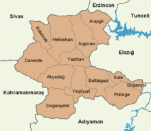
Malatya province is divided into 13 districts:
Demographics


According to German geographers Georg Hassel and Adam Christian Gaspari, Malatya was composed of 1200 to 1500 houses in early 19th century, inhabited by Ottomans, Turkmens, Armenians, and Greeks, while the mountainous areas in the sanjak of Malatya were mostly inhabited by Kurdish tribes such as Reşwan.[5]
The province had a population of 306,882 in 1927 of which 98.9% was Muslim and 1% Christians.[6] Linguistically, Turkish was the most spoken first language at 57.3%, followed by Kurdish at 40.2% and Armenian at 0.9%.[7] The population increased to 410,152 in 1935 of which 99.3% was Muslim and 0.6% Christian.[8] Turkish remained the most spoken first language at 60.2%, followed by Kurdish 39.3% and Armenian at 0.4%.[9] The province had a population of 483,568 in 1950 of which Turkish was spoken by 64.8% of the population, followed by Kurdish at 34.9%. Armenian remained the third most spoken language but decreased to 0.2%.[10] The modern province of Malatya does not fully coincide with the province of Malatya until 1954, before when the province also included the modern Turkish province of Adıyaman,[11] which was more than double Kurdish-speaking than Malatya according to the 1965 census.[12]
It was estimated in 2012 that about 20% to 30% of the province was Alevi of which the vast majority was Kurdish. This group is mostly politically aligned with nationalist Kurdish parties especially after the Sivas Massacre and activity of the Kurdistan Workers' Party since the early 1990s.[13]
History
German academic Barbara Henning describes the province as the regional center of Kurdish nationalism in the early 20th century. During this period, the local governor of the province and mayor of Malatya city were both sympathetic to the Kurdish cause and Celadet Bedir Khan, Kamuran Alî Bedirxan and other members of the Society for the Rise of Kurdistan visited the region various times and established cordial relations with the local tribes including with the Reşwan tribe.[14]
Geography

Local sites
- İnönü University (since 1975)
- Turgut Özal Medical Center (in İnönü University)
- Malatya Erhaç Airport (serving both public and military)
- Eskimalatya (old city centre, historical place)
Bibliography
- Dündar, Fuat (2000), Türkiye nüfus sayımlarında azınlıklar (in Turkish), ISBN 9789758086771
References
- ^ a b "Address-based population registration system (ADNKS) results dated 31 December 2022, Favorite Reports" (XLS). TÜİK. Retrieved 19 September 2023.
- ^ "Li Meletî 3 tax û li Êlihê gundek hatin kerentînekirin" (in Kurdish). Rûdaw. 31 March 2020. Retrieved 27 April 2020.
- ^ "İl ve İlçe Yüz ölçümleri". General Directorate of Mapping. Retrieved 19 September 2023.
- ^ "Kurds, Kurdistān". Encyclopaedia of Islam (2 ed.). BRILL. 2002. ISBN 9789004161214.
Turkish Kurdistan numbers at least 17 of them almost totally:... the provinces of Malatya, Tunceli, Elazığ, Bingöl, Muş, Karaköse (Ağrı), then Adıyaman, Diyarbakır, Siirt, Bitlis and Van; Finally, the southern provinces of Şanlıurfa, Mardin and Çölamerik (Hakkarî)...
- ^ Gaspari, Adam Christian; Hassel, Johann Georg H. (1821). Vollständiges Handbuch der neuesten Erdbeschreibung, von A.C. Gaspari, G. Hassel und J.G.F. Cannabich (J.C.F. Gutsmuths, F.A. Ukert). p. 208-209. Retrieved 7 December 2022.
Die Gebirgsthäler werden meistens von räuberischen Kiurdenstämmen, den Rischwan und Reschi, bewohnt[...] Sie hat 1,200 bis 1,500 Häuser, und wird von Osmanen, Turkmanen, Armeniern und Griechen bewohnt.
- ^ Dündar (2000), p. 159.
- ^ Dündar (2000), p. 157.
- ^ Dündar (2000), p. 168.
- ^ Dündar (2000), pp. 163–164.
- ^ Dündar (2000), p. 188.
- ^ "Adıyaman Tarihi". T.C. Adıyaman Valiliği. Retrieved 29 July 2021.
- ^ Ahn, Elise Soyun (2011). "SEEING TURKISH STATE FORMATION PROCESSES: MAPPING LANGUAGE AND EDUCATION CENSUS DATA" (PDF). p. 105. Retrieved 29 July 2021.
- ^ Massicard, Elise (2012). The Alevis in Turkey and Europe : Identity and Managing Territorial Diversity. Taylor & Francis Group. pp. 170–172. ISBN 9780415667968.
- ^ Henning, Barbara (2018). Narratives of the History of the Ottoman-Kurdish Bedirhani Family in Imperial and Post-Imperial Contexts: Continuities and Changes. University of Bamberg Press. p. 443. ISBN 9783863095512.
External links
- (in Turkish) Malatya governor's official website
- (in Turkish) Malatya
- (in Turkish) Malatya municipality's official website
- (in English) Malatya weather forecast information
- (in English) Malatya directory
- (in Turkish) Malatya Rent A Car


38°29′03″N 38°08′11″E / 38.48417°N 38.13639°E
| International | |
|---|---|
| National | |
| Geographic | |
This article about an Eastern Anatolia Region of Turkey location is a stub. You can help Wikipedia by expanding it. |