
Mirny
Мирный | |
|---|---|
 Flag  Coat of arms | |
Location of Mirny  | |
 Mirny Location of Mirny 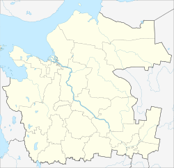 Mirny Mirny (Arkhangelsk Oblast) | |
| Coordinates: 62°46′N 40°20′E / 62.767°N 40.333°E | |
| Country | Russia |
| Federal subject | Arkhangelsk Oblast[1] |
| Founded | November 23, 1960[2] |
| Town status since | February 2, 1966[2] |
| Government | |
| • Body | Council of Town's Deputies[3] |
| Population | |
| • Total | 30,280 |
| • Estimate (2018)[5] | 31,704 (+4.7%) |
| • Subordinated to | town of oblast significance of Mirny[1] |
| • Capital of | town of oblast significance of Mirny[1] |
| • Urban okrug | Mirny Urban Okrug[6] |
| • Capital of | Mirny Urban Okrug[6] |
| Time zone | UTC+3 (MSK |
| Postal code(s)[8] | 164170-164173, 164182–164184, 164188 |
| Dialing code(s) | +7 81834 |
| OKTMO ID | 11725000001 |
| Website | mirniy |
Mirny (Russian: Мирный, IPA: [ˈmʲirnɨj], lit. peaceful) is a closed town in the west of Arkhangelsk Oblast, Russia, serving the Plesetsk Cosmodrome. The town is located 9 kilometers (5.6 mi) from the urban-type settlement of Plesetsk and is connected to it by a road and a railway. Gorodskaya railway station is located within the town, being a terminus to cosmodrome's vast railway system. The Plestsy Airport is also located nearby. Population: 30,280 (2010 Census);[4] 30,502 (2002 Census).[9]
Location and geography
The area administered by the town borders with Kholmogorsky District in the north, Vinogradovsky District in the east, and Plesetsky District in the south and in the west. The area is elongated from the east to the west and is approximately 50 kilometers (31 mi) long and 20 kilometers (12 mi) wide. The town proper is located in the extreme southwestern end of the area. The Yemtsa River flows in the north of the area, whereas the Mekhrenga River crosses it south to north in the eastern part. The whole area belongs to the Northern Dvina River basin. Except for the military installations, it is covered by coniferous forest (taiga).
History
In 1957, an area for the settlement for ballistic missile launch site workers was designated. In 1958, the population of the area, about 4,000, was resettled; the same year the construction started. On November 23, 1960 the settlement of Mirny was established. In 1966, with the development of the cosmodrome, it was designated a closed town. Mirny was never mentioned in the media before 1983.[2]
Administrative and municipal status
Within the framework of administrative divisions, it is incorporated as the town of oblast significance of Mirny—an administrative unit with the status equal to that of the districts.[1] As a municipal division, the town of oblast significance of Mirny is incorporated as Mirny Urban Okrug.[6]
References
Notes
- ^ a b c d e Oblast Law #65-5-OZ
- ^ a b c "Information on Mirny on the official website". Mirny Urban Okrug. Retrieved November 18, 2014.
- ^ Структура городского Совета депутатов Мирного
- ^ a b Russian Federal State Statistics Service (2011). Всероссийская перепись населения 2010 года. Том 1 [2010 All-Russian Population Census, vol. 1]. Всероссийская перепись населения 2010 года [2010 All-Russia Population Census] (in Russian). Federal State Statistics Service.
- ^ "26. Численность постоянного населения Российской Федерации по муниципальным образованиям на 1 января 2018 года". Federal State Statistics Service. Retrieved January 23, 2019.
- ^ a b c Oblast Law #258-vneoch.-OZ
- ^ "Об исчислении времени". Официальный интернет-портал правовой информации (in Russian). June 3, 2011. Retrieved January 19, 2019.
- ^ Почта России. Информационно-вычислительный центр ОАСУ РПО. (Russian Post). Поиск объектов почтовой связи (Postal Objects Search) (in Russian)
- ^ Russian Federal State Statistics Service (May 21, 2004). Численность населения России, субъектов Российской Федерации в составе федеральных округов, районов, городских поселений, сельских населённых пунктов – районных центров и сельских населённых пунктов с населением 3 тысячи и более человек [Population of Russia, Its Federal Districts, Federal Subjects, Districts, Urban Localities, Rural Localities—Administrative Centers, and Rural Localities with Population of Over 3,000] (XLS). Всероссийская перепись населения 2002 года [All-Russia Population Census of 2002] (in Russian).
Sources
- Архангельское областное Собрание депутатов. Областной закон №65-5-ОЗ от 23 сентября 2009 г. «Об административно-территориальном устройстве Архангельской области», в ред. Областного закона №232-13-ОЗ от 16 декабря 2014 г. «О внесении изменений в отдельные Областные Законы в сфере осуществления местного самоуправления и взаимодействия с некоммерческими организациями». Вступил в силу через десять дней со дня официального опубликования. Опубликован: "Волна", №43, 6 октября 2009 г. (Arkhangelsk Oblast Council of Deputies. Oblast Law #65-5-OZ of September 23, 2009 On the Administrative-Territorial Structure of Arkhangelsk Oblast, as amended by the Oblast Law #232-13-OZ of December 16, 2014 On Amending Various Oblast Laws Dealing with the Process of Municipal Self-Government and Relations with Non-Profit Organizations. Effective as of the day which is ten days after the official publication.).
- Архангельское областное Собрание депутатов. Областной закон №258-внеоч.-ОЗ от 23 сентября 2004 г. «О статусе и границах территорий муниципальных образований в Архангельской области», в ред. Областного закона №224-13-ОЗ от 16 декабря 2014 г. «Об упразднении отдельных населённых пунктов Соловецкого района Архангельской области и о внесении изменения в статью 46 Областного закона "О статусе и границах территорий муниципальных образований в Архангельской области"». Вступил в силу со дня официального опубликования. Опубликован: "Волна", №38, 8 октября 2004 г. (Arkhangelsk Oblast Council of Deputies. Oblast Law #258-vneoch.-OZ of September 23, 2004 On the Status and Borders of the Territories of the Municipal Formations in Arkhangelsk Oblast, as amended by the Oblast Law #224-13-OZ of December 16, 2014 On Abolishing Several Inhabited Localities in Solovetsky District of Arkhangelsk Oblast and on Amending Article 46 of the Oblast Law "On the Status and Borders of the Territories of the Municipal Formations in Arkhangelsk Oblast". Effective as of the day of the official publication.).
External links
- Official website
 (in Russian)
 - Official website of Mirny
| Authority control databases: Geographic |
|---|