
Pinehurst, Georgia | |
|---|---|
 Pinehurst City Hall | |
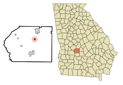 Location in Dooly County and the state of Georgia | |
| Coordinates: 32°11′40″N 83°45′40″W / 32.19444°N 83.76111°W | |
| Country | United States |
| State | Georgia |
| County | Dooly |
| Area | |
| • Total | 1.02 sq mi (2.64 km2) |
| • Land | 1.02 sq mi (2.63 km2) |
| • Water | 0.00 sq mi (0.01 km2) |
| Elevation | 413 ft (126 m) |
| Population (2020) | |
| • Total | 309 |
| • Density | 303.83/sq mi (117.29/km2) |
| Time zone | UTC-5 (Eastern (EST)) |
| • Summer (DST) | UTC-4 (EDT) |
| ZIP code | 31070 |
| Area code | 229 |
| FIPS code | 13-60984[2] |
| GNIS feature ID | 0320662[3] |
| Website | cityofpinehurstga |
Pinehurst is a city in Dooly County, Georgia, United States. The population was 309 in 2020.
YouTube Encyclopedic
-
1/3Views:1 2651 59736 046
-
Avail & NutriSphere-N Testimonial | Wheat, Oats & Corn
-
Luxury Private Retreat Located In Pinehurst, NC
-
Why Filing Bankruptcy May Be The Best Thing You Ever Do - Part 1
Transcription
History
The Georgia General Assembly incorporated Pinehurst in 1895.[4] The community was named for the pine trees abundant in Georgia.[5]
Geography
Pinehurst is located northeast of the center of Dooly County at 32°11′40″N 83°45′40″W / 32.19444°N 83.76111°W (32.194472, -83.761112).[6] U.S. Route 41 passes through the center of town as Pine Avenue, leading north 5 miles (8 km) to Unadilla and south 8 miles (13 km) to Vienna, the county seat. Interstate 75 passes just east of the town limits, with access from Exit 117; I-75 leads north 48 miles (77 km) to Macon and south 56 miles (90 km) to Tifton.
According to the United States Census Bureau, the city has a total area of 1.0 square mile (2.6 km2), all land.[7]
Demographics
| Census | Pop. | Note | %± |
|---|---|---|---|
| 1900 | 330 | — | |
| 1910 | 451 | 36.7% | |
| 1920 | 596 | 32.2% | |
| 1930 | 519 | −12.9% | |
| 1940 | 474 | −8.7% | |
| 1950 | 430 | −9.3% | |
| 1960 | 457 | 6.3% | |
| 1970 | 405 | −11.4% | |
| 1980 | 431 | 6.4% | |
| 1990 | 388 | −10.0% | |
| 2000 | 307 | −20.9% | |
| 2010 | 455 | 48.2% | |
| 2020 | 309 | −32.1% | |
| U.S. Decennial Census[8] | |||
As of the census[2] of 2000, there were 307 people, 145 households, and 87 families residing in the city. By 2020, its population was 309.
References
- ^ "2020 U.S. Gazetteer Files". United States Census Bureau. Retrieved December 18, 2021.
- ^ a b "U.S. Census website". United States Census Bureau. Retrieved January 31, 2008.
- ^ "US Board on Geographic Names". United States Geological Survey. October 25, 2007. Retrieved January 31, 2008.
- ^ Acts of the General Assembly of the State of Georgia. Clark & Hines, State Printers. 1895. p. 270.
- ^ Krakow, Kenneth K. (1975). Georgia Place-Names: Their History and Origins (PDF). Macon, GA: Winship Press. p. 176. ISBN 0-915430-00-2.
- ^ "US Gazetteer files: 2010, 2000, and 1990". United States Census Bureau. February 12, 2011. Retrieved April 23, 2011.
- ^ in"Geographic Identifiers: 2010 Demographic Profile Data (G001): Pinehurst city, Georgia". U.S. Census Bureau, American Factfinder. Retrieved October 22, 2015.[dead link]
- ^ "Census of Population and Housing". Census.gov. Retrieved June 4, 2015.
Municipalities and communities of Dooly County, Georgia, United States | ||
|---|---|---|
| Cities |  | |
| Towns | ||
| Unincorporated communities | ||
| International | |
|---|---|
| National | |