
Sokuluk District
Сокулук району | |
|---|---|
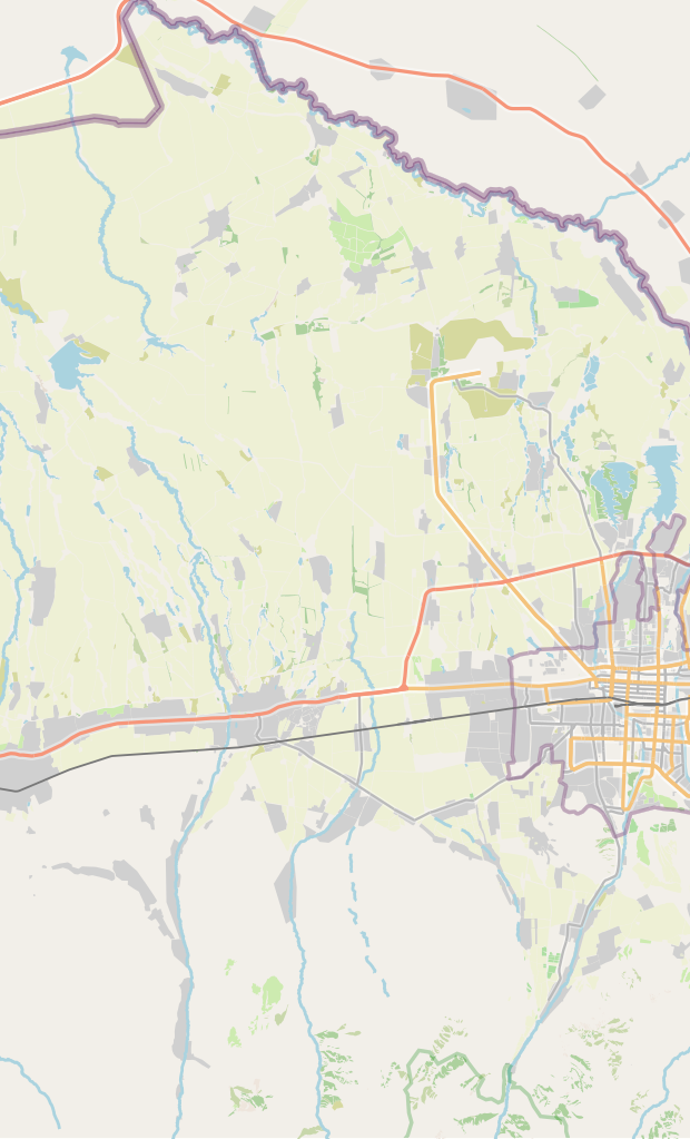
 The border to Sokuluk rayon from Alamüdün rayon along the Osh–Bishkek highway | |
 Coat of arms | |
 | |
| Country | Kyrgyzstan |
| Region | Chüy Region |
| Area | |
| • Total | 2,550 km2 (980 sq mi) |
| Population (2021)[1] | |
| • Total | 194,579 |
| • Density | 76/km2 (200/sq mi) |
| Time zone | UTC+6 |
Sokuluk (Kyrgyz: Сокулук району; Russian: Сокулукский район) is a district of the Chüy Region in northern Kyrgyzstan. Its area is 2,550 square kilometres (980 sq mi),[2] and its resident population was 194,579 in 2021.[1] The administrative seat lies at Sokuluk village.[3]
Population
| Year | Pop. | ±% p.a. |
|---|---|---|
| 1970 | 104,508 | — |
| 1979 | 117,084 | +1.27% |
| 1989 | 131,923 | +1.20% |
| 1999 | 136,124 | +0.31% |
| 2009 | 159,231 | +1.58% |
| 2021 | 194,579 | +1.68% |
| Note: resident population; Sources:[2][1] | ||
Rural communities and villages
In total, Sokuluk District includes 1 town and 68 settlements in 19 rural communities (ayyl aymagy). Each rural community includes one or several villages. The rural communities and settlements in the Sokuluk District are as follows:[3][4]
- town Shopokov
- Asylbash (seat: Asylbash; incl. Kirov)
- At-Bashy (seat: Manas; incl. Ak-Jol, Lesnoye and Tört-Köl)
- Birinchi May (seat: Birinchi May; incl. Natsionalnoye and Panfilov)
- Frunze (seat: Frunze; incl. Komsomol, Ozernoye and Studencheskoye)
- Gavrilovka (seat: Gavrilovka; incl. Jangarach, Romanovka and Shalta)
- Jangy-Jer (seat: Jangy-Jer; incl. Verkhnevostochnoye, Zapadnoye, Zelenoye and Nizhnevostochnoye)
- Jangy-Pakhta (seat: Jangy-Pakhta; incl. Ak-Kashat, Zarya, May and Mirny)
- Kamyshanovka (seat: Kamyshanovka)
- Kaynazarova (seat: Chat-Köl; incl. Belek and Tüz)
- Krupskaya (seat: Sokuluk; incl. Jakynky Aral, Alysky Aral and Birinchi May)
- Kün-Tuu (seat: Kün-Tuu; incl. Dostuk, Kichi-Shalta, Shalta and Chong-Jar)
- Kyzyl-Tuu (seat: Kyzyl-Tuu; incl. Kara-Sakal, Malovodnoye, Novoye and Tokbay)
- Novopavlovka (seat: Novopavlovka; incl. Uchkun)
- Orok (seat: Jal; incl. Jogorku Orok, Kaltar, Kashka-Bash, Tömönkü Orok, Plodovoye, Sarban and Selektsionnoye)
- Saz (seat: Saz; incl. Konush)
- Sokuluk (seat: Sokuluk)
- Tömönkü Chüy (seat: Tömönkü Chüy; incl. Mirnoye, Sadovoye, Severnoye, Stepnoye and Taltak)
- Tösh-Bulak (seat: Tösh-Bulak; incl. Börülü and Chetindi)
- Voyenno-Antonovka (seat: Voyenno-Antonovka)
Manas
Lesnoye
Tört-Köl
Börülü
Chetindi
Gavrilovka
Jangarach
Verkhnevostochnoye
Zapadnoye
Zelenoye
Nizhnevostochnoye
Jangy-Pakhta
Ak-Kashat
Zarya
May
Mirny
Asylbash
Kirovskoye
Kün-Tuu
Dostuk
Kichi-Shalta
Shalta (Kuntuu)
Chong-Jar
Sokuluk (Kr.)
Jakynky Aral
Birinchi May
Kara-Sakal
Novoe
Tokbay
Mirnoye
Sadovoye
Severnoye
Stepnoye
Taltak
Uchkun
Saz
Konush
Kashka-Bash
Tömönkü Orok
Plodovoye
Kaltar
Jogorku Orok
Jal
Sarban
Birinchi May
Natsionalnoye
Panfilov
Frunze
Komsomol
Ozernoye
Studencheskoye
Belek
Tuz
Map of the inhabited part of the Sokuluk District
References
- ^ a b c "Population of regions, districts, towns, urban-type settlements, rural communities and villages of Kyrgyz Republic" (XLS) (in Russian). National Statistics Committee of the Kyrgyz Republic. 2021. Archived from the original on 10 November 2021.
- ^ a b "2009 population and housing census of the Kyrgyz Republic: Chüy Region" (PDF) (in Russian). National Statistics Committee of the Kyrgyz Republic. 2010. pp. 13, 16.
- ^ a b "Classification system of territorial units of the Kyrgyz Republic" (in Kyrgyz). National Statistics Committee of the Kyrgyz Republic. May 2021. pp. 77–80.
- ^ List of Rural Communities of Kyrgyzstan Archived 2010-02-09 at the Wayback Machine
| North Kyrgyzstan |
|  | ||||||||||
|---|---|---|---|---|---|---|---|---|---|---|---|---|
| South Kyrgyzstan |
| |||||||||||
Places adjacent to Sokuluk District | ||||||||||||||||
|---|---|---|---|---|---|---|---|---|---|---|---|---|---|---|---|---|
| ||||||||||||||||
42°51′09″N 74°13′16″E / 42.8526°N 74.221°E