
| Surma River Śoraboti | |
|---|---|
 | |
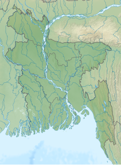 Location in Bangladesh | |
| Etymology | Named after the hue of Kohl during storm seasons on the river, it's referred to as "surma" in the Sylheti language. |
| Location | |
| Country | Bangladesh |
| Division | Sylhet Division |
| District | Sylhet, Sunamganj, Kishoreganj |
| Physical characteristics | |
| Source | Barak River |
| Mouth | Meghna River |
• coordinates | 25°01′N 91°21′E / 25.017°N 91.350°E |
| Length | 249 km (155 mi) |
| Depth | |
| • average | 282 feet (86 m) |
| • maximum | 550 feet (170 m) |
The Surma (Sylheti: ꠍꠥꠞꠝꠣ ꠉꠣꠋ, romanized: surmā gang, Bengali: সুরমা নদী, romanized: Śurmā nôdī) is a major river in Bangladesh, part of the Surma-Meghna River System. It starts when the Barak River from northeast India divides at the Bangladesh border into the Surma and the Kushiyara rivers. It ends in Kishoreganj District, above Bhairab Bāzār,[1] where the two rivers rejoin to form the Meghna River. The waters from the river ultimately flows into the Bay of Bengal.
YouTube Encyclopedic
-
1/3Views:12 30968221 285
-
Visit Sylhet Bank of River Surma Mazar Hazrat Shah Jalal Dorgah Tour Bangladesh Song Tagor
-
Surma River Cruise Restaurant, Sylhet City সুরমার জলে ঢেউ খেলা এক অসাধারণ রেস্টুরেন্ট
-
TIMPAIMUKH DAM (BAD) DRYING SURMA RIVER IN SYLHET. MUST WATCH.
Transcription
Course
From its source in the Manipur Hills near Mao Songsang, the river is known as the Barak River. At the border with Bangladesh, the river divides into two branches, with the northern branch being called the Surma River and the southern the Kushiyara River. This is where the river enters the Sylhet Depression (or trough) which forms the Surma Basin.[2]
The Surma is fed by tributaries from the Meghalaya Hills to the north, and is also known as the Baulai River after it is joined by the south-flowing Someshwari River.
The Kushiyara receives tributaries from the Sylhet Hills and Tripura Hills to the south, the principal one from the Tripura Hills being the Manu. The Kushiyara is also known as the Kalni River after it is joined by a major offshoot (distributary) from the Surma. When the Surma and the Kushiyara finally rejoin in Kishoreganj District above Bhairab Bazar, the river is known as the Meghna River.
The Surma passes through many haors.[3]
Gallery


References
- ^ Bhairab Bāzār (Approved) at GEOnet Names Server, United States National Geospatial-Intelligence Agency
- ^ Mannan, Abdul (2002) "Stratigraphic evolution and geochemistry of the Neogene Surma Group, Surma Basin, Sylhet, Bangladesh" University of Oulu, Oulu, Bangladesh, ISBN 951-42-6710-9
- ^ Niyogi, PK (17 November 2008). "Water, Water everywhere". Travel 8th Day. Kolkata: The Statesman.
There was a motor launch from Mohanganj to Sunamganj. That was a 12-hour journey one-way, cutting right across the haors ... the launch cruised into the Surma River. I looked around and it was water, water everywhere. The river was lost in what the locals called Alir Haor.
External links
- Chowdhury, Masud Hasan (2012). "Surma River". In Islam, Sirajul; Jamal, Ahmed A. (eds.). Banglapedia: National Encyclopedia of Bangladesh (Second ed.). Asiatic Society of Bangladesh.
| Authority control databases: National |
|---|