
Timimoun Province
ولاية تيميمون | |
|---|---|
 | |
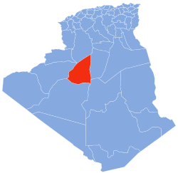 Map of Algeria highlighting Timimoun | |
| Coordinates: 29°15′30″N 00°13′50″E / 29.25833°N 0.23056°E | |
| Country | Algeria |
| Capital | Timimoun |
| Government | |
| • Wāli | Mabrouk Aoun |
| Area | |
| • Total | 65,203 km2 (25,175 sq mi) |
| Elevation | 276 m (906 ft) |
| Population (2008)[1] | |
| • Total | 122,019 (2,008) |
| Time zone | UTC+01 (CET) |
| Area Code | +213 (0) 49 |
| ISO 3166 code | DZ-01 |
| Districts | 4 |
| Municipalities | 10 |
The Wilaya of Timimoun (Arabic: ولاية تيميمون) is an Algerian province created in 2019, previously, a delegated wilaya created in 2015. It is in the Algerian Sahara.
Geography
The wilaya of Timimoun is in the Algerian Sahara; its area is 131,220 km².
It is delimited by:
- to the north by the El Bayadh Province;
- to the east by the El Menia Province and In Salah Province;
- to the west by the Bechar Province and Béni Abbès Province;
- and to the south by the Adrar Province.
History
The wilaya of Timimoun was created on November 26, 2019.
Previously, it was a delegated wilaya, created according to the law n° 15–140 of May 27, 2015, creating administrative districts in certain wilayas and fixing the specific rules related to them, as well as the list of municipalities that are attached to it. Before 2019, it was attached to the Adrar Province.
Organization of the wilaya
During the administrative breakdown of 2015, the delegated wilaya of Timimoun is made up of 4 districts and 10 communes.
List of walis
| District | Commune | Arabic |
|---|---|---|
| Aougrout District | Aougrout | أوﻗﺮت |
| Deldoul | دﻟﺪول | |
| Metarfa | المطارفة | |
| Charouine District | Charouine | ﺷﺮوﻳﻦ |
| Ouled Aissa | وﻻد ﻋﻴﺴﻰ | |
| Talmine | ﻃﺎﻟﻤﻴﻦ | |
| Timimoun District | Ouled Said | أولاد السعيد |
| Timimoun | ﺗﻴﻤﻴﻤﻮن | |
| Tinerkouk District | Ksar Kaddour | قصر قدور |
| Tinerkouk | تينركوك |
References
- ^ Office National des Statistiques, Recensement General de la Population et de l’Habitat 2008 Archived July 24, 2008, at the Wayback Machine Preliminary results of the 2008 population census. Accessed on July 2, 2008.
Places adjacent to Timimoun Province | |
|---|---|
|  | |