
Топлички округ Toplički okrug | |
|---|---|
        Images from the Toplica District | |
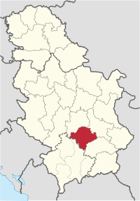 Location of the Toplica District within Serbia | |
| Coordinates: 43°14′N 21°36′E / 43.233°N 21.600°E | |
| Country | |
| Administrative center | Prokuplje |
| Government | |
| • Commissioner | Nebojša Vukadinović |
| Area | |
| • Total | 2,231 km2 (861 sq mi) |
| Population (2022 census)[1] | |
| • Total | 77,341 |
| • Density | 35/km2 (90/sq mi) |
| ISO 3166 code | RS-21 |
| Municipalities | 4 |
| Settlements | 267 |
| - Cities and towns | 4 |
| - Villages | 263 |
The Toplica District (Serbian: Топлички округ, romanized: Toplički okrug, pronounced [tǒplit͡ʃkiː ôkruːɡ]) is an administrative district in southern Serbia, named after the river Toplica. As of 2022 census, the district has a population of 77,341 inhabitants,[1] making it the smallest district by population in Serbia. Its administrative center is the city of Prokuplje.
YouTube Encyclopedic
-
1/5Views:2 8098 3231 7897049 218
-
Toplica (Gostivar) nga drona
-
Blace - Serbia
-
[35, 38] South Serbia road trip: Prokuplje - Blace
-
prokuplje...seen from my lenses
-
Prokuplje moj grad
Transcription
Municipalities
It encompasses the city of Prokuplje and three municipalities:
Demographics
| Year | Pop. | ±% |
|---|---|---|
| 1948 | 141,502 | — |
| 1953 | 149,421 | +5.6% |
| 1961 | 141,141 | −5.5% |
| 1971 | 129,542 | −8.2% |
| 1981 | 121,933 | −5.9% |
| 1991 | 111,813 | −8.3% |
| 2002 | 102,075 | −8.7% |
| 2011 | 91,754 | −10.1% |
| 2022 | 77,900 | −15.1% |
| Source: [2][1] | ||
As of 2022 census, the district has a population of 77,900 inhabitants.[1]
Ethnic groups
Ethnic composition of the municipality:
| Ethnic group | Population | % |
|---|---|---|
| Serbs | 73,045 | 94.44% |
| Romani | 3,734 | 4.82% |
| Macedonians | 68 | 0.08% |
| Albanians | 28 | 0.03% |
| Bulgarians | 25 | 0.03% |
| Total | 77,341 | 100% |
See also
References
- ^ a b c d "Prvi rezultati Popisa stanovništva, domaćinstava i stanova 2022". stat.gov.rs (in Serbian). 21 December 2022. Retrieved 16 February 2023.
d
- ^ "2011 Census of Population, Households and Dwellings in the Republic of Serbia" (PDF). stat.gov.rs. Statistical Office of the Republic of Serbia. Retrieved 12 January 2017.
Note: All official material made by Government of Serbia is public by law. Information was taken from official website.
External links
Wikimedia Commons has media related to Toplica District.
Places adjacent to Toplica District | ||||||||||||||||
|---|---|---|---|---|---|---|---|---|---|---|---|---|---|---|---|---|
| ||||||||||||||||
| National | |
|---|---|
| Geographic | |