
Urambo | |
|---|---|
| Etymology: named for King Mirambo | |
 | |
| Country | |
| Region | Tabora Region |
| Area | |
| • Total | 5,415 km2 (2,091 sq mi) |
| Population (2022) | |
| • Total | 260,322 |
| • Density | 48/km2 (120/sq mi) |
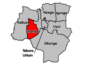
Urambo is one of the seven districts of the Tabora Region of Tanzania. It is bordered to the north by the Kaliua District, to the east by the Uyui District, to the southeast by the Sikonge District, and to the southwest by the Katavi Region. Its administrative seat is the town of Urambo.
YouTube Encyclopedic
-
1/1Views:816
-
EP.9 African History Class 1
Transcription
Etymology
The name "Urambo" (Nyamwezi language: ) meaning Home of the Urambo, a 19th century kingdom of the Nyamwezi people.
History
In the 19th century, Urambo was a kingdom. It came about under the leadership of King Mirambo, who united the territory of Uyowa, which had been ruler by his father, with Ulyankhulu.[1]
Geography
Southern Urambo district is the Ugalla River National Park
Demographics
According to the 2002 Tanzania National Census, the population of the Urambo District was 260,322.[2][3]
Between 2002 and 2012, Kaliua District was split off from Urambo District. That is why the population of Urambo District declined in this period. According to the 2012 Tanzania National Census, the population of Urambo District was 192,781.[4]
Economy
Unpaved Trunk road T18 from Tabora to Kigoma passes through the district.[5]
The Tanzanian Central Line train - from Dar es Salaam to Kigoma - passes through the district. There is a train station in Urambo town.
Government
In 2002, Urambo District was administratively divided into 26 wards. As of 2012, only 16 wards remained after Kaliua District was split off.[4]
Wards
- Imalamakoye
- Kapilula
- Kasisi
- Kiloleni
- Muungano
- Nsenda
- Songambele
- Ugalla
- Ukondamoyo
- Urambo
- Usisya
- Ussoke
- Itundu
- Uyogo
- Uyumbu
- Vumilia (English meaning: tolerate)
Sources
References
- ^ Dictionary of African Biography, p. 224
- ^ "Urambo (District, Tanzania) - Population Statistics, Charts, Map and Location". www.citypopulation.de. Retrieved 2024-02-11.
- ^ "2002 Population and Housing Census: Tabora: Urambo". Archived from the original on 2008-11-18.
- ^ a b "Census 2012". National Bureau of Statistics. Archived from the original on 5 March 2016. Retrieved 29 February 2016.
- ^ "Road Networks". Tanroads. Archived from the original on 3 April 2016. Retrieved 23 February 2016.
5°00′S 31°55′E / 5.000°S 31.917°E
| International | |
|---|---|
| National | |
This Tabora Region location article is a stub. You can help Wikipedia by expanding it. |