
Yellow Bluff, Alabama | |
|---|---|
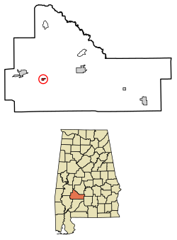 Location of Yellow Bluff in Wilcox County, Alabama. | |
| Coordinates: 31°57′36″N 87°28′56″W / 31.96000°N 87.48222°W | |
| Country | United States |
| State | Alabama |
| County | Wilcox |
| Area | |
| • Total | 0.63 sq mi (1.62 km2) |
| • Land | 0.63 sq mi (1.62 km2) |
| • Water | 0.00 sq mi (0.00 km2) |
| Elevation | 102 ft (31 m) |
| Population (2020) | |
| • Total | 208 |
| • Density | 332.27/sq mi (128.21/km2) |
| Time zone | UTC-6 (Central (CST)) |
| • Summer (DST) | UTC-5 (CDT) |
| FIPS code | 01-83976 |
| GNIS feature ID | 0157287 |
Yellow Bluff is a town in Wilcox County, Alabama, United States. It incorporated in 1985.[2] Per the 2020 census, the population was 208.[3]
YouTube Encyclopedic
-
1/1Views:916 037
-
Malicious Contact Ejection
Transcription
Geography
Yellow Bluff is located at 31°57′36″N 87°28′56″W / 31.96000°N 87.48222°W (31.959922, -87.482175).[4]
According to the U.S. Census Bureau, the town has a total area of 0.5 square miles (1.3 km2), all land.
Its altitude is 31 m above sea level.
Demographics
| Census | Pop. | Note | %± |
|---|---|---|---|
| 1990 | 245 | — | |
| 2000 | 181 | −26.1% | |
| 2010 | 188 | 3.9% | |
| 2020 | 208 | 10.6% | |
| U.S. Decennial Census[5] 2010[6] 2020[7] | |||
2020 census
| Race / Ethnicity (NH = Non-Hispanic) | Pop 2010[6] | Pop 2020[7] | % 2010 | % 2020 |
|---|---|---|---|---|
| White alone (NH) | 1 | 3 | 0.53% | 1.44% |
| Black or African American alone (NH) | 187 | 205 | 99.47% | 98.56% |
| Native American or Alaska Native alone (NH) | 0 | 0 | 0.00% | 0.00% |
| Asian alone (NH) | 0 | 0 | 0.00% | 0.00% |
| Pacific Islander alone (NH) | 0 | 0 | 0.00% | 0.00% |
| Some Other Race alone (NH) | 0 | 0 | 0.00% | 0.00% |
| Mixed Race or Multi-Racial (NH) | 0 | 0 | 0.00% | 0.00% |
| Hispanic or Latino (any race) | 0 | 0 | 0.00% | 0.00% |
| Total | 188 | 208 | 100.00% | 100.00% |
2000 Census
As of the census[8] of 2000, there were 181 people, 67 households, and 48 families residing in the town. The population density was 334.5 inhabitants per square mile (129.2/km2). There were 73 housing units at an average density of 134.9 per square mile (52.1/km2). The racial makeup of the town was 92.82% Black or African American, 5.52% White, 1.10% Native American, and 0.55% from two or more races. 1.10% of the population were Hispanic or Latino of any race.
There were 67 households, out of which 34.3% had children under the age of 18 living with them, 28.4% were married couples living together, 41.8% had a female householder with no husband present, and 26.9% were non-families. 26.9% of all households were made up of individuals, and 11.9% had someone living alone who was 65 years of age or older. The average household size was 2.70 and the average family size was 3.31.
In the town, the population was spread out, with 29.8% under the age of 18, 8.3% from 18 to 24, 32.0% from 25 to 44, 14.4% from 45 to 64, and 15.5% who were 65 years of age or older. The median age was 33 years. For every 100 females, there were 77.5 males. For every 100 females age 18 and over, there were 64.9 males.
The median income for a household in the town was $11,389, and the median income for a family was $13,125. Males had a median income of $68,750 versus $16,250 for females. The per capita income for the town was $9,322. About 43.4% of families and 47.5% of the population were below the poverty line, including 50.0% of those under the age of eighteen and 58.3% of those 65 or over.
References
- ^ "2020 U.S. Gazetteer Files". United States Census Bureau. Retrieved October 29, 2021.
- ^ 1990 Alabama Census.
- ^ "Yellow Bluff town, Alabamaa". United States Census Bureau. Retrieved April 15, 2022.
- ^ "US Gazetteer files: 2010, 2000, and 1990". United States Census Bureau. February 12, 2011. Retrieved April 23, 2011.
- ^ "Decennial Census of Population and Housing by Decades". US Census Bureau.
- ^ a b "P2 Hispanic or Latino, and Not Hispanic or Latino by Race – 2010: DEC Redistricting Data (PL 94-171) – Yellow Bluff town, Alabama". United States Census Bureau.
- ^ a b "P2 Hispanic or Latino, and Not Hispanic or Latino by Race – 2020: DEC Redistricting Data (PL 94-171) – Yellow Bluff town, Alabama". United States Census Bureau.
- ^ "U.S. Census website". United States Census Bureau. Retrieved January 31, 2008.
31°57′36″N 87°28′56″W / 31.959922°N 87.482175°W
Municipalities and communities of Wilcox County, Alabama, United States | ||
|---|---|---|
| City | 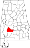 | |
| Towns | ||
| CDPs | ||
| Unincorporated communities | ||
| Ghost towns | ||