
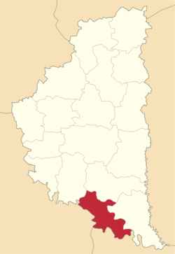
Zalishchyky Raion
Заліщицький район | |
|---|---|
 | |
| Coordinates: 48°45′N 25°47′E / 48.750°N 25.783°E | |
| Country | |
| Region | Ternopil Oblast |
| Established | 1940 |
| Disestablished | 18 July 2020 |
| Admin. center | Zalishchyky |
| Subdivisions | List
|
| Area | |
| • Total | 684 km2 (264 sq mi) |
| Population (2020) | |
| • Total | 44,955 |
| • Density | 66/km2 (170/sq mi) |
| Time zone | UTC+02:00 (EET) |
| • Summer (DST) | UTC+03:00 (EEST) |
| Area code | 380-3554 |
Zalishchyky Raion (Ukrainian: Заліщицький район) was a raion (district) of Ternopil Oblast. The administrative centre and largest town was Zalishchyky. The rest of the district's population lived in one of 35 village councils or 53 rural settlements. The raion was abolished on 18 July 2020 as part of the administrative reform of Ukraine, which reduced the number of raions of Ternopil Oblast to three. The area of Zalishchyky Raion was merged into Chortkiv Raion.[1][2] The last estimate of the raion population was 44,966 (2020 est.).[3]
YouTube Encyclopedic
-
1/5Views:4209 0529662 1851 156
-
Zalishchyky
-
Zalishchyky from above · Ukraїner
-
Zalishchyky | Unexplored Ukraine
-
Wedding Procession - Ukraine- Zalishchyky area
-
Beyond The Clouds - Zalishchyky | True Sight Project
Transcription
Subdivisions
At the time of disestablishment, the raion consisted of two hromadas:[4]
- Tovste settlement hromada with the administration in the urban-type settlement of Tovste;
- Zalishchyky urban hromada with the administration in Zalishchyky.
Demographics
- Population: 53,400 (2001)[5]
- (In 1989 the population was 56,300 – a decline of 5%)
- Density: 85
- Life expectancy: 71
- % Urban population: 25%[6]
Geography
- Area: 684 km²[7]
Communities
Towns
Urban type settlements
Villages
- Anhelivka
- Bedrykivtsi
- Berestok
- Blyshchanka
- Buriakivka
- Dobrivliany
- Dorohychivka
- Duniv
- Duplyska
- Dzvyniach
- Hlushka
- Holihrady
- Holovchyntsi
- Horodok
- Hynkivtsi
- Ivane-Zolote
- Kasperivtsi
- Khartonivtsi
- Khmeleva
- Kolodribka
- Korolivka
- Koshylivtsi
- Kulakivtsi
- Lysivtsi
- Lysychnyky
- Lytiachi
- Myshkiv
- Nahoriany
- Novosilka
- Nyrkiv
- Pechorna
- Podillia
- Popivtsi
- Rozhanivka
- Sadky
- Shchytivtsi
- Shutromyntsi
- Shypivtsi
- Slobidka
- Solone
- Stavky
- Svershkivtsi
- Synkiv
- Torske
- Uhrynkivtsi
- Ustechko
- Vorvulyntsi
- Vyhoda
- Vyniatyntsi
- Vynohradne
- Yakubivka
- Zelenyi Hai
- Zozulyntsi
References
- ^ "Про утворення та ліквідацію районів. Постанова Верховної Ради України № 807-ІХ". Голос України (in Ukrainian). 2020-07-18. Retrieved 2020-10-03.
- ^ "Нові райони: карти + склад" (in Ukrainian). Міністерство розвитку громад та територій України.
- ^ Чисельність наявного населення України на 1 січня 2020 року / Population of Ukraine Number of Existing as of January 1, 2020 (PDF) (in Ukrainian and English). Kyiv: State Statistics Service of Ukraine. Archived (PDF) from the original on 28 September 2023.
- ^ "Заліщицька районна рада (состав до 2020 г.)" (in Russian). Портал об'єднаних громад України.
- ^ "Всеукраїнський перепис населення 2001 | English version | Results | General results of the census | Total number of actual population | Ternopil' region". www.ukrcensus.gov.ua. Archived from the original on 2005-01-16.
- ^ "Всеукраїнський перепис населення 2001 | English version | Results | General results of the census | Urban and rural population | Ternopil' region". Archived from the original on 2007-09-30. Retrieved 2006-09-11.
- ^ "Countries and Territories since 1900". ethnia.org. Retrieved 2023-03-26.
| International | |
|---|---|
| National | |
| Other | |